Kappa Bridge
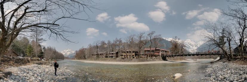
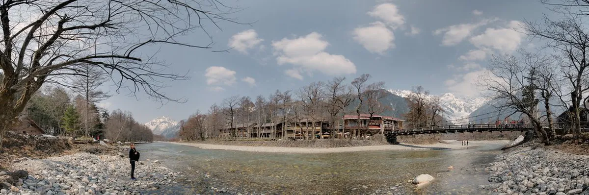
Kamikochi's iconic wooden suspension bridge over the Azusa River, framed by the Hotaka peaks.
Visitor guide →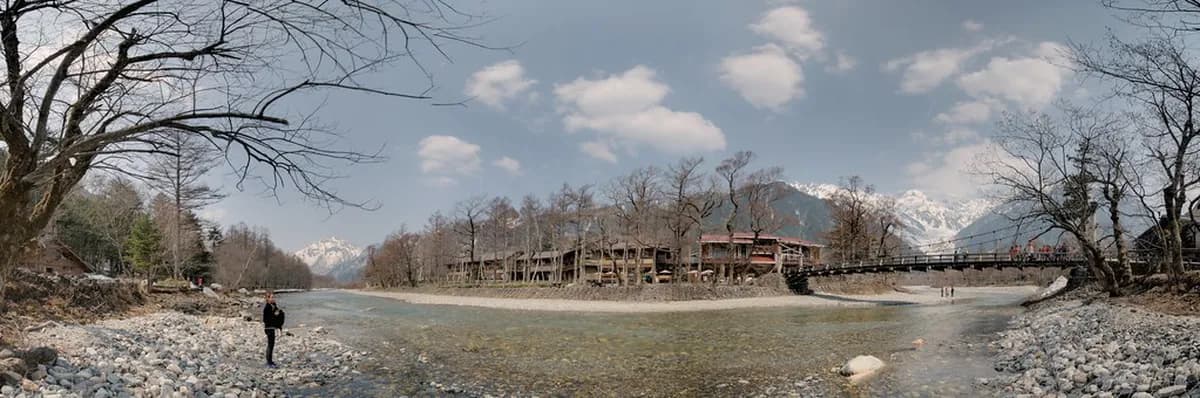
Kamikochi attractions guide for 2026: the 5 best things to do, flat river walks vs day hikes, free vs paid sights, car-free bus access from Sawando and Hirayu, the mid-April to mid-November season, and a suggested one-day itinerary.
Kamikochi is a high-altitude river valley in the Northern Japan Alps, sitting at around 1,500 metres in the mountains west of Matsumoto in Nagano Prefecture. It is not a town you stay in casually — it is a protected national-park basin where the things to do in Kamikochi are almost entirely outdoors: a turquoise river, mirror-still ponds, larch and willow forest, and a wall of 3,000-metre peaks rising straight out of the valley floor. Two facts shape every visit here, so read them before you do anything else. First, Kamikochi is car-free — private vehicles are banned year-round, and you reach it only by shuttle bus or taxi from the Sawando or Hirayu Onsen transfer car parks. Second, Kamikochi is open only from mid-April to mid-November (the 2026 season runs roughly 17 April to 15 November); the valley is sealed off and unserved in winter. Get those two right and the rest of the trip is simple.
This is the entity hub for our Kamikochi coverage. Below are the 5 attractions that consistently reward the time it takes to reach them — each card links to a full visitor guide with directions, walking times, and practical tips. After the cards we explain how the sights connect on foot, the difference between the flat river walks and the real day hikes, what costs money (very little does), a suggested one-day itinerary, and the access and season logistics that trip up first-timers. For the deep-dive blog companion, see our Kamikochi attractions blog guide, and for the wider region, our Japan Alps attractions hub.
Kamikochi's iconic wooden suspension bridge over the Azusa River, framed by the Hotaka peaks.
Visitor guide →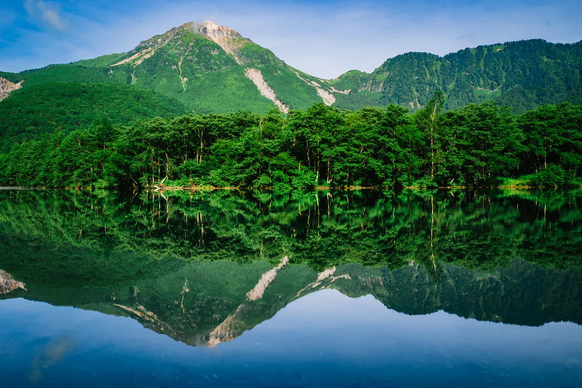
A still mirror pond with standing dead trees and Mt Hotaka reflections, formed by Mt Yake's 1915 eruption.
Visitor guide →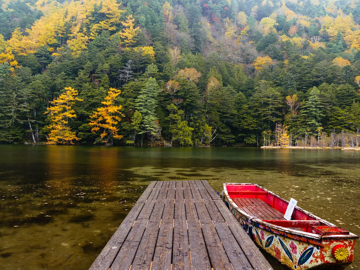
A sacred clear pond beside Hotaka Shrine's inner shrine, an hour's flat walk upriver from Kappa Bridge.
Visitor guide →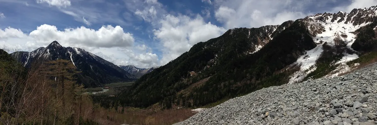
A wetland and the trailhead for the Dakesawa hike toward the Hotaka range, with boardwalks and alpine views.
Visitor guide →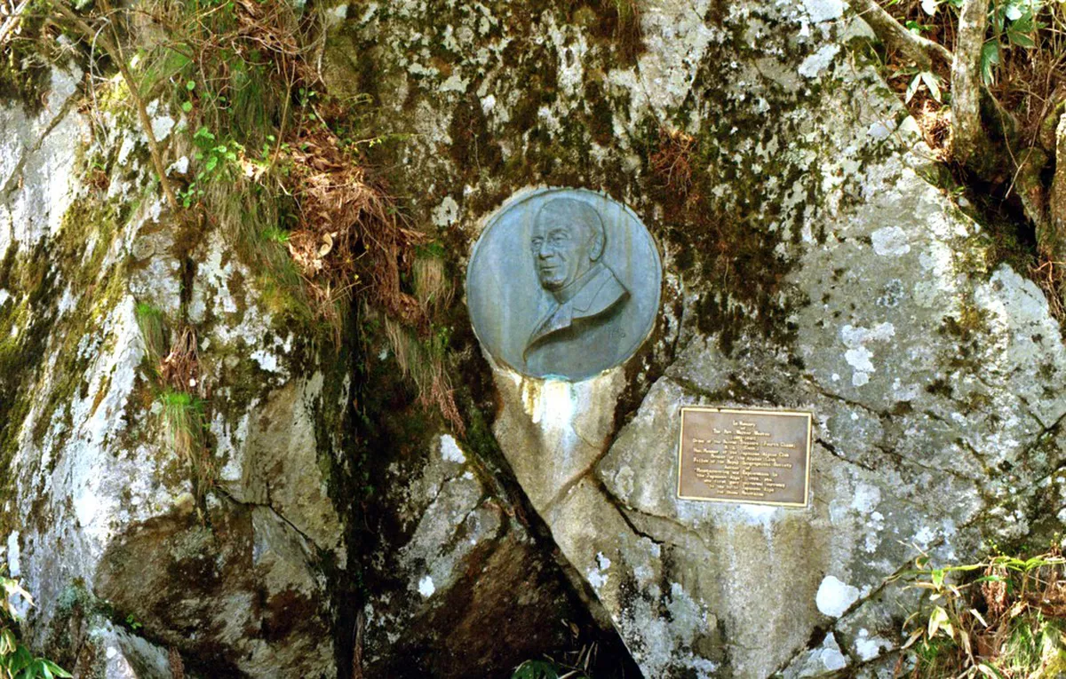
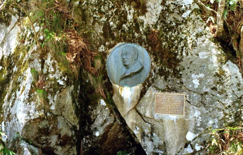
A relief plaque honouring Walter Weston, the British missionary who popularised recreational climbing in the Japan Alps.
Visitor guide →The best thing about sightseeing in Kamikochi is that almost everything strings together along one mostly-flat trail beside the Azusa River, so you rarely have to choose between attractions — you simply walk past them in sequence. Here is how the five top sights relate to each other and where each one sits along the valley.
Kappa Bridge (Kappabashi) is the heart of Kamikochi and your default meeting point. This wooden suspension bridge over the milky-turquoise Azusa River stands a few minutes' walk from the bus terminal, framed by the jagged Hotaka peaks, and almost every walk in the valley starts or ends here. The hotels, restaurants and the free Kamikochi Visitor Center cluster around it. See our Kappa Bridge visitor guide for the best photo angles and how to dodge the midday crowd.
Taisho Pond lies about 45 minutes downstream (south-west) of Kappa Bridge, and is often the first thing visitors see because the bus passes it on the way in. It was formed in 1915 when the nearby Mt. Yakedake volcano erupted and dammed the river; the result is a glassy, shallow pond with standing dead trees and a clean reflection of Mt. Hotaka on still mornings. Details and the best light are in our Taisho Pond visitor guide.
Myojin Pond sits roughly an hour upstream (north-east) of Kappa Bridge, beside the inner shrine of Hotaka Jinja, on the way toward Myojin Bridge. It is a sacred, crystal-clear pond ringed by conifer forest — the quietest and most atmospheric of the three ponds, and the only one that charges a small entry fee (it is shrine land). Walking times and the small admission are covered in our Myojin Pond visitor guide.
Dakesawa Marsh (Dakesawa Shitsugen) is a five-to-ten-minute walk from Kappa Bridge on the south bank, a small wetland of boardwalks and clear pools that doubles as the trailhead for the Dakesawa day hike up toward the Hotaka range. It is the easiest place in Kamikochi to get an alpine-meadow feel without committing to a climb. Read the Dakesawa Marsh visitor guide for the boardwalk loop and the hike option.
The Weston Monument is a bronze relief plaque set into the rock on the south bank, about 15 minutes' walk downstream from Kappa Bridge toward Taisho Pond. It honours Walter Weston, the British missionary who popularised recreational mountaineering in the Japan Alps and effectively put Kamikochi on the map for hikers. It is a quick, free stop you pass anyway. See the Weston Monument visitor guide.
The single most useful thing to understand about activities in Kamikochi is that there are two completely different tiers of walking, and most first-time visitors only need the first.
The flat valley walks follow the Azusa River along well-maintained gravel paths and boardwalks, with almost no elevation gain. The classic route — Taisho Pond → Tashiro Pond → Kappa Bridge → Myojin Pond → Myojin Bridge and back — is essentially flat, takes three to five hours at a gentle pace, and needs no hiking experience, no permits, and no special gear beyond comfortable shoes. This is what the vast majority of day-trippers do, and it takes in four of the five sights above. You can also shorten it to just the Kappa Bridge ↔ Myojin loop (about two hours round trip) if time is tight.
The genuine day hikes are a different undertaking. Trails such as the climb to Dakesawa Hut, the ascent of Mt. Yakedake, or the long approaches toward the summits of Mt. Hotaka and Mt. Yari involve serious elevation gain, alpine terrain, and full mountain conditions — these are for experienced, properly-equipped hikers, often as multi-day trips staying in mountain huts. If you only have a day and limited gear, stay on the valley floor; the flat walks deliver the famous views with none of the risk. Our Kamikochi hiking trails guide breaks every route down by difficulty, distance and time.
Kamikochi is one of the best-value sightseeing destinations in Japan because the scenery itself is free. There is no entrance fee to the valley, no charge for Kappa Bridge, Taisho Pond, Dakesawa Marsh, the Weston Monument, the river trails, or the excellent Kamikochi Visitor Center (open daily 08:00–17:00 in season). The only on-site sight that charges is Myojin Pond, where a small fee (a few hundred yen) is collected because it sits on Hotaka Shrine land.
Where the money actually goes is transport. Because the valley is car-free, your real cost is the shuttle bus or taxi from the transfer car parks, plus parking if you drive that far. Budget roughly ¥2,000–¥3,200 round trip for the bus from Sawando, and note an important catch: the local Alpico bus and the Matsumoto Dentetsu railway are run by a private company, so a Japan Rail Pass does not cover the final leg to Kamikochi — it only gets you as far as Matsumoto or Takayama. There are also no ATMs and no banks in Kamikochi and very few trash cans, so bring enough cash and plan to carry your rubbish out.
If you have a single day — which is what most visitors have — this sequence covers all five attractions on flat ground without backtracking:
With two days you can add a Dakesawa or Mt. Yakedake day hike, or simply slow down and stay overnight to catch dawn at Taisho Pond. See our where to stay in Kamikochi guide for in-valley lodges and the nearby onsen towns.
This is the logistic that surprises first-timers, so it is worth stating plainly: you cannot drive into Kamikochi. Private cars, motorbikes and rental vehicles are banned year-round to protect the environment and ease congestion. Instead you drive (or take a train) to a transfer point, leave the car, and ride a shuttle bus or taxi in:
Kamikochi is strictly seasonal: the valley opens in mid-April and closes in mid-November (the 2026 season is approximately 17 April to 15 November), and there is no public access, transport or services through the deep-snow winter. Within that window:
Whatever month you choose, mornings are cold even in summer at this altitude, so pack a layer. Our best time to visit Kamikochi guide gives a month-by-month breakdown of weather, crowds and what's blooming.
Yes — it is widely considered one of the most beautiful mountain valleys in Japan, with the Azusa River, mirror ponds and the 3,000-metre Hotaka peaks all visible from flat, easy trails. Because the scenery is the attraction and almost everything is free, it offers exceptional value, and the car-free rule keeps it peaceful.
Kamikochi is open from mid-April to mid-November only — the 2026 season runs roughly 17 April to 15 November. It is completely closed in winter, with no transport, lodging or services, because of heavy snow.
No. Private cars are banned year-round. You must park at the Sawando (Matsumoto side) or Hirayu Onsen (Takayama side) transfer car parks and take a shuttle bus or taxi the final stretch into the valley.
One full day is enough to see all five top attractions on the flat river walk (Taisho Pond, Weston Monument, Kappa Bridge, Dakesawa Marsh and Myojin Pond). Add a second day if you want a real mountain day hike such as Dakesawa or Mt. Yakedake, or to catch dawn at Taisho Pond.
The valley itself, Kappa Bridge, Taisho Pond, Dakesawa Marsh, the Weston Monument, the trails and the Visitor Center are all free. The only on-site charge is a small admission for Myojin Pond, which sits on Hotaka Shrine land. Your main cost is the shuttle bus or taxi in.
Only partway. The JR Pass gets you to Matsumoto or Takayama, but the final leg — the Matsumoto Dentetsu railway and the Alpico bus into Kamikochi — is run by a private company and is not covered, so you pay separately for that.
No. The signature views come from flat, well-paved river walks that need no hiking experience or gear. The strenuous summit climbs are entirely optional and aimed at experienced, equipped hikers.
No — there are no banks or ATMs in the valley, and very few trash cans. Bring enough cash for the day and plan to carry your rubbish out with you.
Use these companion guides to plan around this hub:
For background and reference, see the Kamikochi entry on Wikipedia and the Kamikochi travel guide on Wikivoyage.