Kamikochi Hiking Trails Travel Guide
Plan kamikochi hiking trails with top picks, timing tips, trail details for Kappa Bridge, Taisho Pond and Myojin Pond, and practical booking advice for 2026.
On this page
Kamikochi Hiking Trails
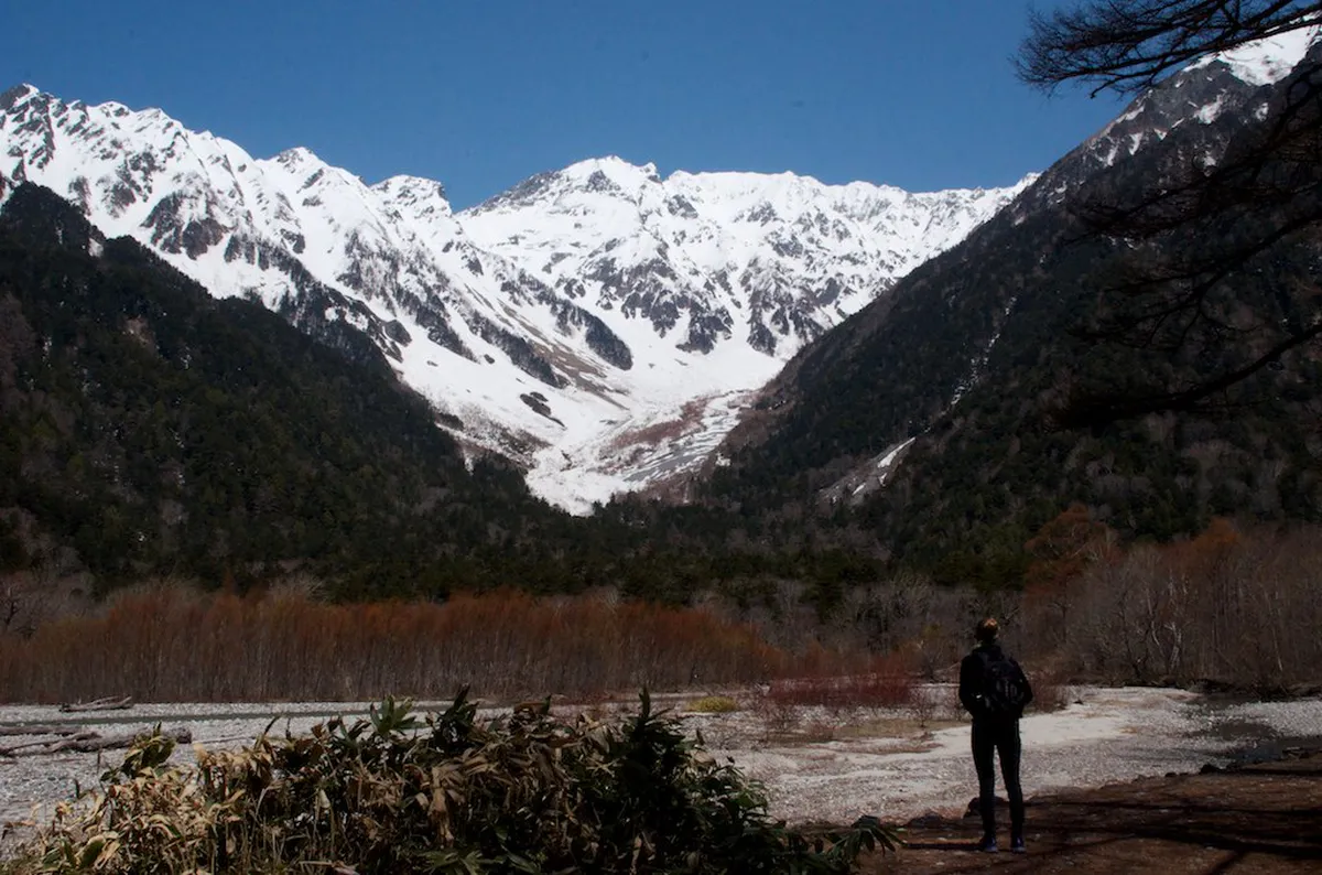
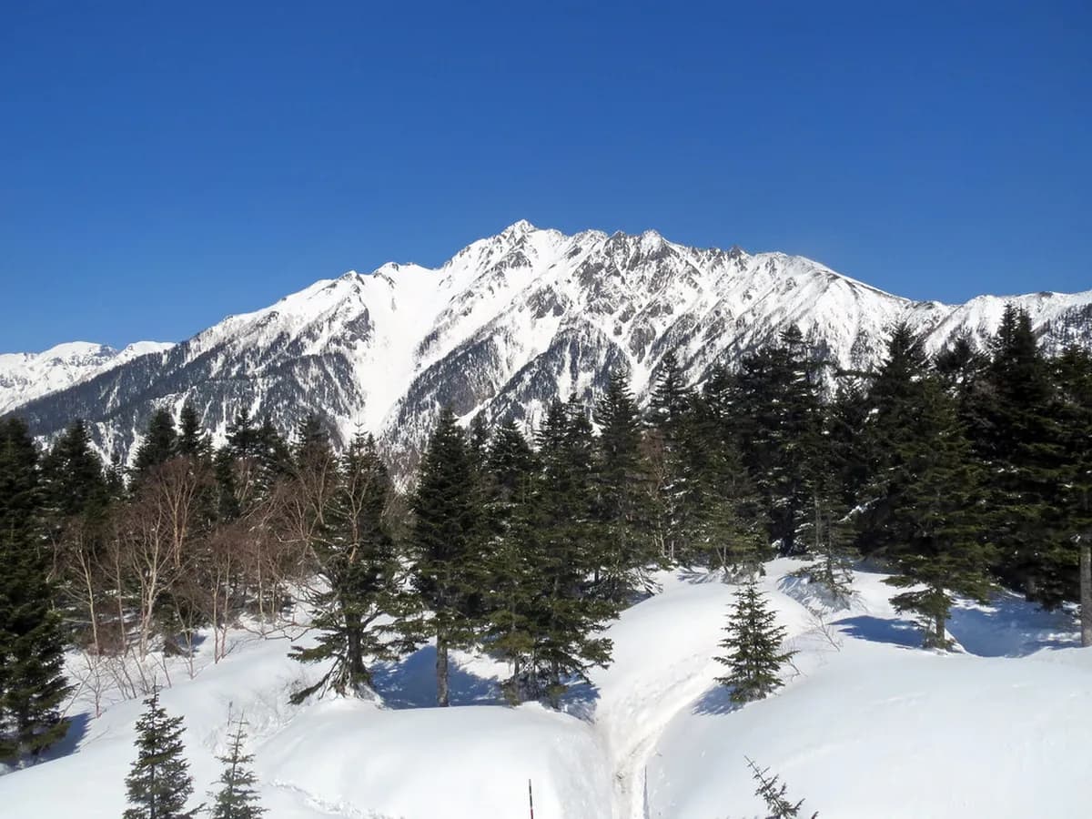
Kamikochi sits at 1,500 metres above sea level in the heart of Chubu-Sangaku National Park. The valley is hemmed in by peaks topping 3,000 metres and cut through by the crystal-clear Azusa River. Few places in Japan combine such dramatic alpine scenery with trails that are genuinely accessible to every fitness level.
The kamikochi hiking trails range from a gentle riverside stroll past Kappa Bridge to multi-day ascents of Mt. Oku-Hotaka (3,190 m), the highest peak in the Northern Alps. Most day visitors stick to the flat valley floor and still return with memories that rival much harder hikes. This guide covers the four core trails, practical logistics, and the one decision that shapes your whole trip: day visit or overnight stay.
Free guide: Japan's Hidden Gems
12 under-the-radar places beyond Tokyo & Kyoto — with the best season to visit each and a local tip you won't find in the guidebooks.
What to Expect on Kamikochi Hiking Trails
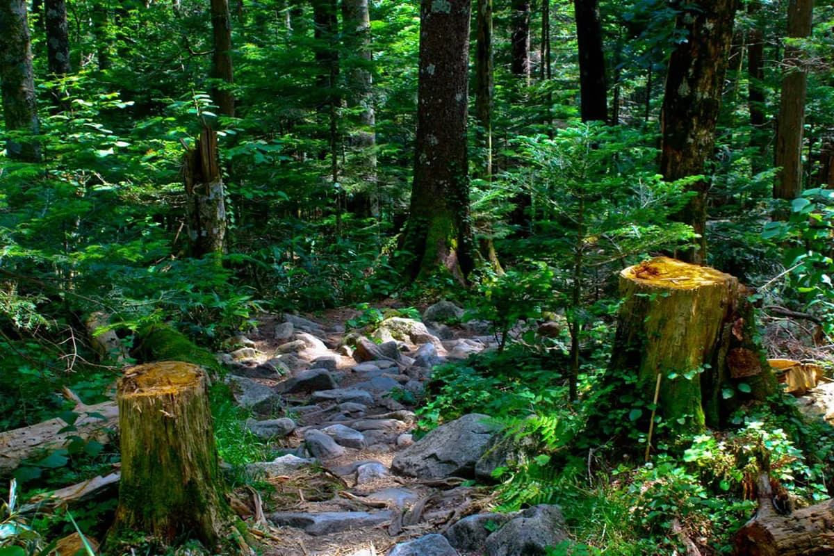
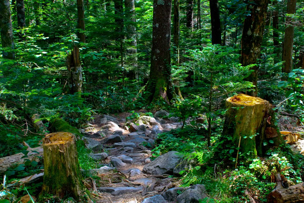
Kamikochi's valley floor trails are flat to gently inclined, well-marked with bilingual signage, and lined with restrooms and small food stalls every couple of kilometres. The terrain underfoot is compacted gravel and boardwalk, so trail shoes are fine for the main paths. Proper hiking boots matter most if you plan to leave the valley floor and climb toward the surrounding peaks.

Kamikochi's main attractions are all reachable on foot without technical gear, which makes the park unusually welcoming for first-time mountain walkers in Japan. Easy hikes with impressive views can be completed in three to five hours at a relaxed pace. The park sees heavy traffic during summer school holidays and autumn foliage season, so arriving before 9 am makes a real difference.
Private cars are banned inside the park, which keeps the trails noticeably quieter and the air cleaner than most Japanese day-trip destinations. Wildlife — including Japanese macaques, serows, and a range of alpine birds — appears more often on weekday mornings when visitor numbers drop. The park is open from mid-April to mid-November; it closes completely in winter due to snow and road conditions.
Best Day Hikes in Kamikochi
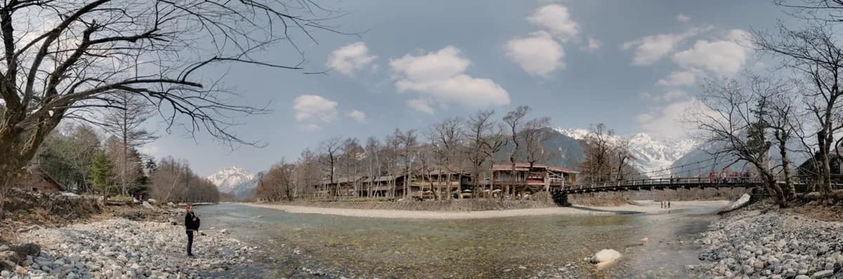
The most popular route links Kappa Bridge, Myojin Pond, Dakesawa Marsh, and Taisho Pond in a single day. Covering roughly nine kilometres, the full loop takes two to three hours at a leisurely pace, or up to five hours if you stop often to photograph the reflections and wildlife. Most hikers use Kappa Bridge as both the start and end point since it sits just a short walk from the main bus terminal.
Taisho Pond lies about 20 minutes south of the bus terminal and is one of Kamikochi's most photogenic spots. The pond was formed in 1915 when Mt. Yakedake erupted and dammed the Azusa River, leaving a shallow lake dotted with the silver skeletons of submerged larch trees. In calm weather the surface mirrors Mt. Yakedake perfectly, making it a priority stop for photographers arriving early before the wind picks up.
Myojin Pond sits roughly three kilometres north of Kappa Bridge and rewards the extra walk with a scene straight out of a Japanese ink painting. The still water reflects rock faces and forest so clearly that it is hard to tell where the mountain ends and the reflection begins. A small entry fee of around 300 yen gives access to the inner pond area and the dockside bell of Hotaka Inner Shrine.
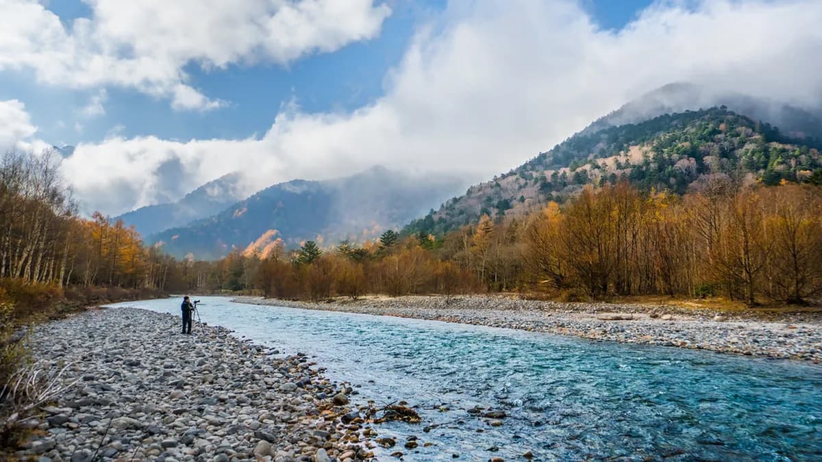
Dakesawa Marsh extends further north beyond Myojin Pond and is the section most day visitors skip, which is precisely what makes it worth the effort. The boardwalk crosses open wetland with unobstructed views of the Hotaka massif and sees noticeably fewer hikers than the southern stretches. Returning via the left bank of the Azusa River completes the loop and offers the most scenic riverside walking in the whole valley.
- Kappa Bridge Loop (easy, ~2–3 hrs)
- The iconic suspension bridge over the Azusa River serves as the classic Kamikochi starting point.
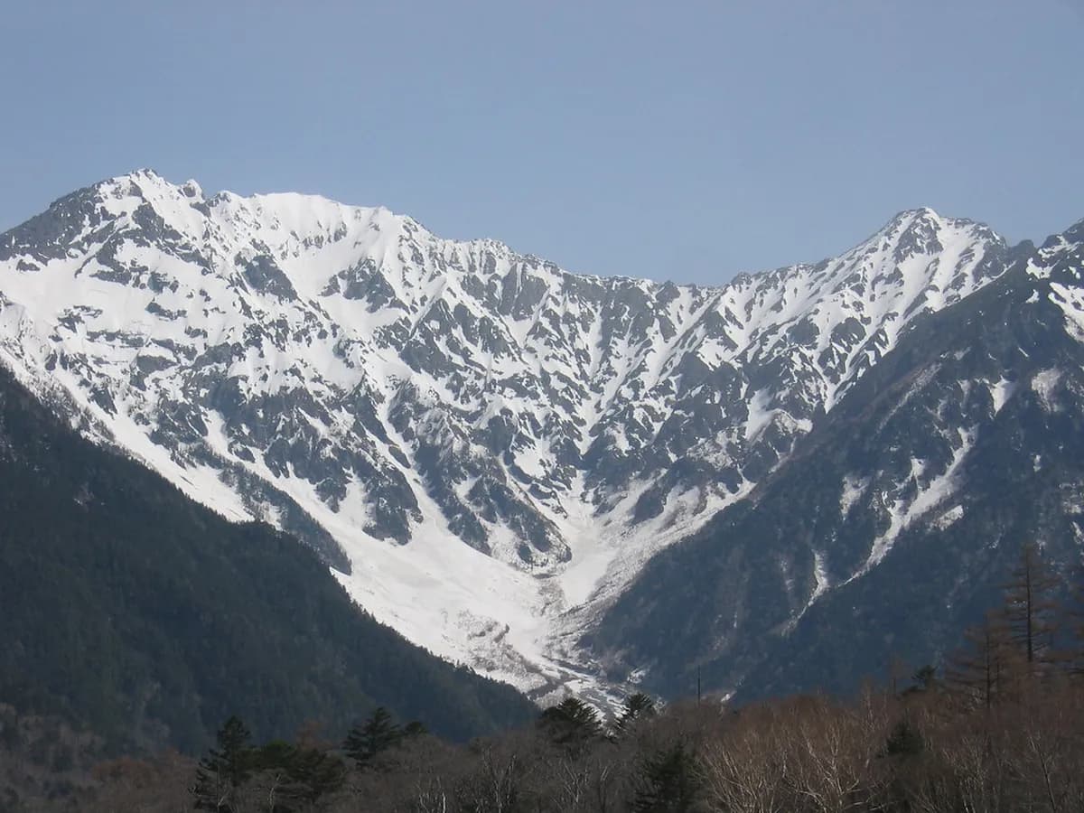
- Mt. Hotaka frames the view from the bridge on clear mornings, creating one of Japan's most photographed alpine scenes.
- Food stalls and a visitor information centre are located within a few minutes' walk for supplies or maps.
- Taisho Pond Trail (easy, ~1 hr return)
- The pond formed in 1915 after the Yakedake eruption dammed the Azusa River, leaving a lake of submerged larch trees.
- Calm mornings give mirror-like reflections of the active volcano Mt. Yakedake, which remains a striking backdrop.
- The path from the bus terminal is flat and entirely paved, making it suitable even for light footwear.
- Myojin Pond and Hotaka Shrine (moderate, ~4 hrs return)
- Myojin Pond sits three kilometres north of Kappa Bridge and charges roughly 300 yen for access to the inner shrine area.
- The famous dockside bell at Hotaka Inner Shrine is rung by visitors offering a prayer, adding a cultural dimension to the hike.
- The left bank of the Azusa River offers more scenic variety on the return leg than the right bank path.
- Dakesawa Marsh Extension (moderate, ~5–6 hrs return)
- Dakesawa lies beyond Myojin Pond and sees far fewer visitors, giving a quieter alpine-wetland experience.
- Open boardwalks provide clear sightlines across marsh grass to the Hotaka peaks rising directly ahead.
- Combining Dakesawa with the full valley loop covers around nine kilometres and rewards hikers with the widest variety of scenery.
Tips for Hiking Kamikochi
Leaving Matsumoto on the first or second morning bus means arriving before the peak crowds, which typically build between 10 am and 2 pm. The first departures run from around 5 am, and the direct bus from Matsumoto takes about 45 minutes. Buying your return ticket before you board is strongly recommended, as seats on the last buses fill up quickly during summer and autumn.
The last bus leaves Kamikochi at around 4 pm, and the timetable shifts depending on the season — always confirm the schedule at the terminal before heading deep into the valley. Even with a roundtrip ticket, you must collect a numbered return stub at the departure stop so staff know your seat assignment. Missing the final bus is a genuinely costly mistake, as the only alternative is an overnight stay or an expensive taxi to the nearest road.
Kamikochi has no rubbish bins anywhere in the park, so every piece of packaging you bring in must leave with you. Buying snacks and drinks before entering, rather than relying on the pricey concession stalls, saves both money and packaging hassle. A small dry bag or zip-lock inside your daypack keeps used wrappers separate from clean gear on the trail.
The left bank of the Azusa River consistently offers better views than the right bank on the outward leg from Kappa Bridge. Bears are present in Kamikochi — the park recommends making noise on narrow trails and carrying or renting a bear bell near the visitor centre. Dressing in layers is essential even in summer, as the valley sits at 1,500 metres and afternoon temperatures can drop sharply after rain.
How Long Do You Need in Kamikochi
A single day is enough to walk the core loop linking Kappa Bridge, Myojin Pond, and Taisho Pond — roughly nine kilometres with a comfortable five hours on the trail. Day-trippers from Matsumoto get there and back in a total journey time of under two hours, making the logistics straightforward. The trade-off is that you will share the best viewpoints with several hundred other visitors and lose the soft morning and evening light.
Staying overnight inside the park shifts the whole experience. Early morning, before the first buses arrive, the valley belongs to a handful of guests and the wildlife that drifts onto the paths. Lodge and ryokan rates inside the park start at around 15,000 to 20,000 yen per person including two meals, which is a significant premium over Matsumoto options.
Two or more days are only necessary if you plan to tackle one of the alpine routes above the valley floor. Multi-day hikes toward Yarigatake (2–3 days) or the Panorama Ginza Trail (3–4 days) require mountain-hut reservations made weeks in advance. For the vast majority of visitors, one full day satisfies the valley hikes completely, and an overnight stay is a luxury worth the cost rather than a practical necessity.
How to Get to Kamikochi
Kamikochi is not accessible by private car — the road closes to personal vehicles, and the only way in is by bus or taxi from designated car parks. From Matsumoto, the simplest option is a direct highway bus to the Kamikochi Bus Terminal, taking around 45 minutes and costing about 4,650 yen roundtrip. Buses from Matsumoto sell out early on weekends and public holidays in summer and autumn, so booking ahead via the Alpico Group website is wise.
From Takayama, the route runs via Hirayu Onsen, where passengers transfer to a local bus for the final 30-minute leg. The total journey from Takayama takes around 1.5 hours and costs roughly 5,300 yen roundtrip. This option suits travellers on the Matsumoto–Takayama corridor who want to add Kamikochi to a larger Northern Alps loop.
JR Pass holders benefit most by taking the Shinkansen or limited express to Matsumoto, where the Matsumoto Electric Railway also connects to the bus interchange. That combined train-and-bus option costs around 5,300 yen roundtrip but offers the flexibility of multiple departure times. Travelling from Tokyo, Osaka, or Kyoto by direct highway bus is technically possible but takes over five hours each way — the train-and-bus combination is a far better use of time.
Where to Stay Near Kamikochi
Staying inside the park means waking to pre-dawn silence before the buses arrive, which is the clearest argument for paying the premium. The Gosenjaku Hotel, Imperial Hotel Kamikochi, and several traditional lodges sit along the Azusa River and charge from around 15,000 to 40,000 yen per person per night including meals. Rooms book out months ahead for Golden Week (late April) and the October foliage peak, so early reservations are not optional.
Accommodation options near Kamikochi extend to campgrounds within the park that cost considerably less and suit budget-conscious hikers. Tent sites require advance reservations and guests must carry all food waste out of the park — no exceptions. The campground near Konashidaira is the most popular option and sits within easy walking distance of Kappa Bridge.
Matsumoto makes the best external base for most visitors, offering a wide range of budget hostels, business hotels, and ryokan from around 5,000 to 12,000 yen per night. The city has excellent dining, Matsumoto Castle, and good transit connections that make an extra night worthwhile. Takayama is a slower-paced, more atmospheric alternative base with preserved Edo-era streets and its own strong craft sake and cuisine culture.
Frequently Asked Questions
Is Kamikochi difficult to hike?
Most Kamikochi trails are not difficult. The main valley paths are flat to gently inclined, well-marked, and suitable for beginners or hikers with limited experience. The full loop covering Kappa Bridge, Myojin Pond, and Taisho Pond is around nine kilometres and takes two to five hours depending on pace. Alpine routes above the valley floor are a different matter — those require full mountain gear and experience.
How many days do you need in Kamikochi?
One day is enough to complete the core valley loop. Arriving early and leaving on the late afternoon bus gives five to six comfortable hours on the trail. An overnight stay is worth it for early morning light and fewer crowds, but it is a luxury rather than a necessity. Allow two or more days only if you plan to hike above the valley toward the high alpine routes like Yarigatake.
When is the best time to hike Kamikochi?
The park is open from mid-April to mid-November. The best time to visit Kamikochi for hiking is late spring (late May to June) for fresh greenery, or autumn (late September to mid-October) for spectacular foliage. Summer is busiest but still enjoyable. Mid-October typically marks peak autumn colour before temperatures drop sharply in November.
Are there bears in Kamikochi?
Yes, Asiatic black bears live in Chubu-Sangaku National Park and are occasionally sighted in and around Kamikochi. The park recommends making noise while hiking, travelling in groups, and carrying a bear bell — available to rent near the visitor centre. Bears are generally shy and confrontations are rare, but checking current trail advisories at the visitor information centre on arrival is good practice.
Can you hike Kamikochi without a guide?
Absolutely. The valley floor trails are independently walkable with a free paper map from the visitor centre or a PDF from Kamikochi.org. Signage is bilingual and the paths are clear even in poor weather. Guided tours add value mainly for alpine ascents above the valley, where route-finding and mountain safety knowledge matter more.
Kamikochi's hiking trails deliver an alpine experience that few places in Japan can match, and the valley's flat terrain means almost anyone can enjoy them. From the iconic view at Kappa Bridge to the quiet wetlands of Dakesawa, each section of the trail offers something distinct. The key to a great day is simple: arrive early, bring your own snacks, and watch the last-bus time carefully.
Whether you choose a single day trip from Matsumoto or an overnight stay inside the park, plan your visit around the spring greenery or autumn foliage for the most rewarding colours. Booking buses and park lodges well ahead — especially for peak weekends in September and October — removes the main logistical headaches. Explore the Japan Activity blog for more itinerary ideas to pair with your Kamikochi hike across the Northern Alps region.
For tickets, hours and visitor details, see our Myojin Pond Visitor Guide: Hiking, Attractions & Travel Tips, Kamikochi attractions hub.
Free guide: Japan's Hidden Gems
12 under-the-radar places beyond Tokyo & Kyoto — with the best season to visit each and a local tip you won't find in the guidebooks.
You might also like
Continue reading
More guides you'll find useful