Taisho Pond Kamikochi Travel Guide
Explore Taisho Pond Kamikochi — volcanic origin, ghost trees, mirror reflections, trail distances, seasonal tips, and practical how-to-get-there advice.
On this page
Taisho Pond Kamikochi: Trail, Views & Tips
Taisho Pond in Kamikochi is one of the most visually arresting spots in the Japanese Alps. Formed by a volcanic eruption in 1915, the pond holds a silent drama that photographs cannot fully capture. Dead trees stand upright in the still water, their bare trunks reflected alongside the snow-dusted peaks of Mt Hotaka and Mt Yake. For visitors exploring Kamikochi's top attractions, Taisho Pond is often the highlight they remember longest.
The good news is that reaching Taisho Pond requires no mountaineering skill. The trail from Kappa Bridge covers a flat 3.5 km and takes roughly an hour at a comfortable pace. Families, older travelers, and first-time visitors to Japan's alpine valley all manage it with ease. This guide covers the trail route, what you will see along the way, transport options, and the best times to go.
Free guide: Japan's Hidden Gems
12 under-the-radar places beyond Tokyo & Kyoto — with the best season to visit each and a local tip you won't find in the guidebooks.
What Makes Taisho Pond So Striking
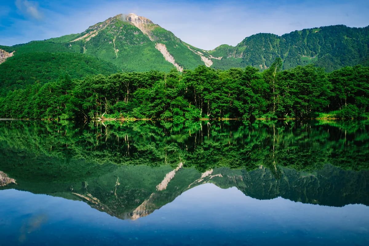
Taisho Pond was created on June 6, 1915, when Mt Yake erupted and sent a massive mudflow down the valley. The debris dammed the Azusa River, flooding the surrounding forest and forming a broad, shallow lake. The trees that were submerged never decomposed in the cold, mineral-rich water. Their silvery trunks still pierce the surface today, giving the pond its ghostly, otherworldly character.
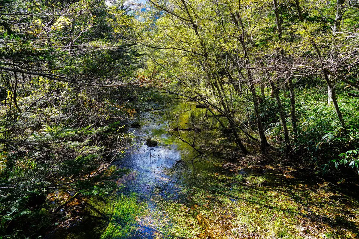
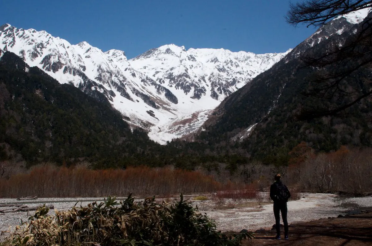
On calm mornings, the water acts like a mirror. The jagged ridgeline of Mt Hotaka and the cone of Mt Yake reflect so clearly that some photos look like double exposures. This mirror effect is what draws photographers from across Japan and beyond. Even on overcast days, mist drifting off the water creates its own quiet beauty.
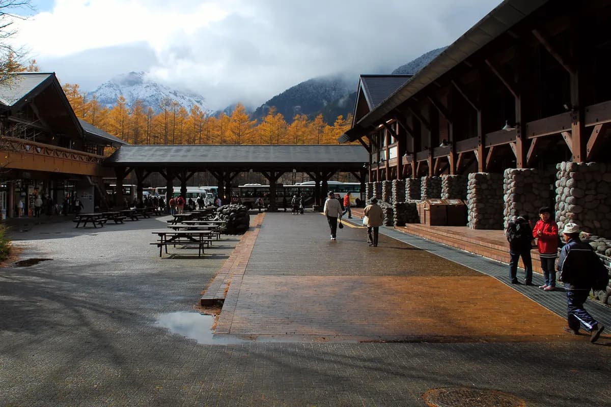
The pond sits at around 1,490 metres above sea level, inside Chubu-Sangaku National Park. Private cars are banned from the Kamikochi valley, keeping the air clean and the soundscape peaceful. Benches line the pond's edge, and a small rest area with a gift shop and restaurant sits near the bus stop. Most visitors stay thirty minutes to an hour, though the scene rewards those who linger.
Starting from Kappa Bridge
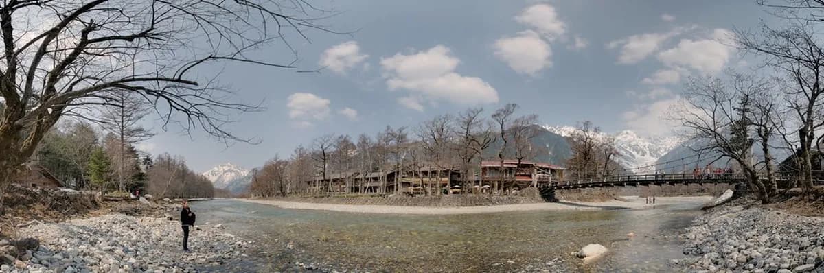
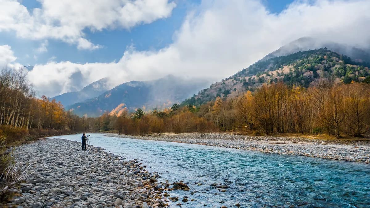
Kappa Bridge is the central hub of Kamikochi and the natural starting point for this hike. From the bridge, the trail heads south along the west bank of the Azusa River. The iconic Kappa Bridge is worth a few minutes — peaks framing the wooden suspension span make a classic valley view. Pick up the southern trail immediately after and you are on your way.
The one-way distance from Kappa Bridge to Taisho Pond is approximately 3.5 km, just over two miles. At an easy walking pace, that translates to about one hour each way. The full round trip, at a relaxed pace with photo stops, takes around two to two and a half hours. Plan to finish the return leg well before dusk, as the trails have no lighting after dark.
The path is graded flat throughout, with no meaningful elevation gain. This makes the Taisho Pond trail one of the most accessible hikes in the Japanese Alps. Children, older visitors, and travelers who are not regular hikers all complete it without difficulty. The key is pacing — there is no reason to rush, and the river views reward a slow stroll.
What to Expect on the Trail
The trail surface shifts between compacted dirt, wooden boardwalks, and gravel sections. All of it is well maintained and easy to follow without a map. Sturdy walking shoes or trainers with good grip are the right choice — sandals become uncomfortable on gravel. Bring a light jacket even on warm days, since temperatures at 1,500 metres can drop quickly.
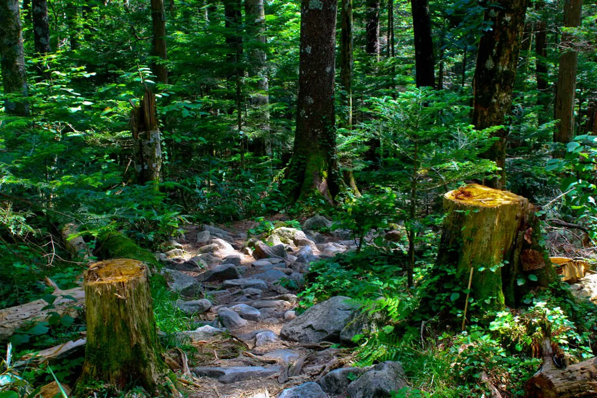
Roughly halfway along the route, the trail reaches Tashiro Bridge (田代橋), a wooden river crossing. The river runs fast and clear beneath, with mountain peaks framing the view upstream — a great photo stop. After crossing, the trail moves to the east bank and the landscape shifts noticeably. Raised boardwalks carry walkers through open marshlands where the sky opens up wide.
Wildlife sightings are common on this section of trail. Japanese macaques sometimes forage in the riverside vegetation, and sika deer graze in the meadows near the pond. Moving quietly and keeping a respectful distance is the rule — animals here are wild even if habituated. Carry water and a snack for the stretch between Kappa Bridge and the rest area at the pond.
- What to pack for the Taisho Pond trail
- Sturdy walking shoes grip well on gravel and wet boardwalks.
- A light waterproof jacket handles the quick weather shifts at altitude.
- Water and a snack keep energy up on the 3.5 km stretch between stops.
- A camera or phone with a wide lens captures the full panorama at the pond.
Arriving at Taisho Pond
The pond comes into view gradually as the boardwalk trail emerges from the last stand of trees. The first impression is silence — the wide open water absorbs sound in a way the forest trail does not. The dead trees appear almost immediately, standing at irregular angles in the shallows. Some trunks have weathered to pale silver; others lean sharply as the shoreline has slowly shifted over the past century.
On still mornings, the reflection of Mt Yake fills the entire southern half of the pond. The mountain's symmetrical cone doubles in the water, creating a composition that needs no editing. Mt Hotaka's jagged ridgeline appears on the opposite side, completing a panorama spanning nearly 180 degrees. For photographers, arriving before 9 am captures the softest light and the calmest water surface.
Wooden benches sit along the bank, positioned to face the best angles. The small rest area near the bus stop sells drinks, light snacks, and a few souvenirs. Spending thirty minutes here at a bench is a better use of time than rushing straight back. The scene changes as clouds shift and the light moves, so patience pays off.
Getting to and from Taisho Pond
No private vehicles are permitted inside the Kamikochi valley, so all visitors arrive by bus or taxi. From Matsumoto, buses run to Kamikochi with the journey taking about an hour. Alternatively, the Matsumoto Electric Railway connects Matsumoto to Shin-Shimashima, where a direct bus continues into the valley. Check current timetables when planning, as schedules vary between peak season and shoulder periods.
Taisho Pond has its own dedicated bus stop called Taisho-ike, near the rest area at the pond's edge. This makes a one-way hike very practical: ride the bus to Taisho-ike first, then walk the 3.5 km back north at your own pace. Arriving at the pond fresh means you enjoy the highlight early, then walk back as energy allows. The reverse direction — hiking south, busing back — works equally well for those who prefer to end at the pond.
Kamikochi is open from mid-April to November 15 each year. The valley closes entirely in winter due to heavy snowfall. During the open season, the first buses enter the valley around 5 am and the last buses depart in the early evening. Confirm the exact last bus time at the terminal before setting out, especially if you plan a late-afternoon visit.
- Transport options to Taisho Pond
- Bus from Matsumoto to Kamikochi Bus Terminal takes around one hour.
- A local bus inside the valley stops directly at Taisho-ike near the pond.
- Taxis are available but cost significantly more than the bus fare.
- Hiking the full 3.5 km trail from Kappa Bridge is the most popular approach.
Best Time to Visit Taisho Pond
Early morning is the single best time to visit Taisho Pond, regardless of season. The water is calmest before the valley heats up and a mid-morning breeze picks up. Arriving by 8 am means most bus tour groups have not yet reached the valley floor. Soft light, still water, and near-empty benches make an early start well worth the effort.
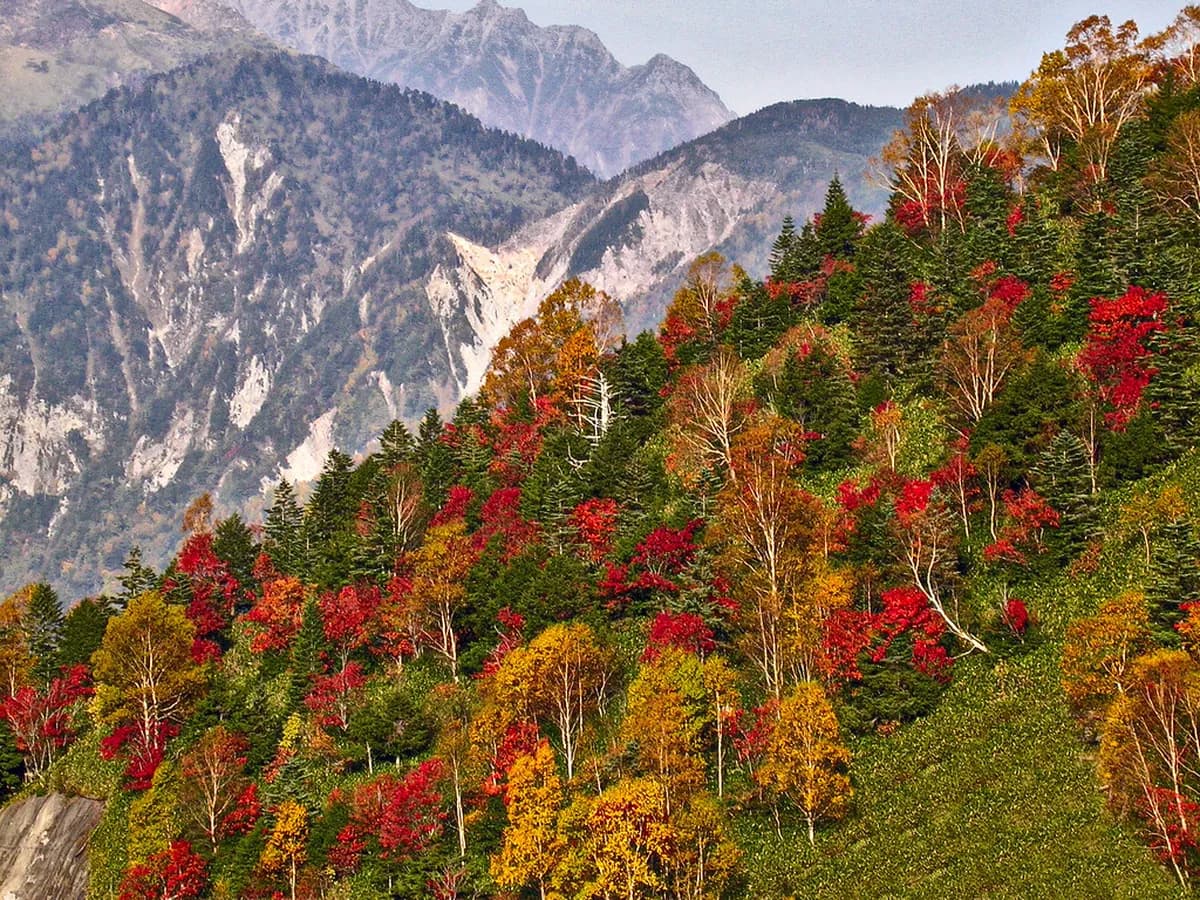
Late April through May brings the most dramatic contrast at the pond. Dead trees stand against fresh green foliage while the peaks still carry deep snow. Autumn — mid-October through early November — delivers orange and red maple leaves framing the water. The best months to visit Kamikochi for foliage fall right before the valley closes for winter.
Summer (July to August) is the busiest period across the whole valley. Midday foot traffic concentrates near Kappa Bridge, meaning Taisho Pond is often quieter than the central area. Overcast days are underrated here — mist drifting across the surface adds atmosphere clear skies cannot replicate. Any season during the open period has something to offer; arriving early and staying patient is the consistent advantage.
Frequently Asked Questions
Can you swim in Taisho Pond Kamikochi?
Swimming is not permitted in Taisho Pond. The pond sits within Chubu-Sangaku National Park, where strict conservation rules protect the water and its ecosystem. The water is also extremely cold year-round due to the high altitude and volcanic mineral content. Visitors are welcome to walk along the bank and take photographs from the shore.
How long does it take to walk from Kappa Bridge to Taisho Pond?
The one-way trail from Kappa Bridge to Taisho Pond is approximately 3.5 km and takes about one hour at a relaxed pace. The full round trip runs two to two and a half hours with stops for photos. The path is flat and well-maintained, making it manageable for most visitors including families and older travelers.
Is there a bus to Taisho Pond in Kamikochi?
Yes. Taisho Pond has its own bus stop called Taisho-ike, served by the local bus that runs along the valley floor. Many visitors take the bus one way and walk the other direction on the trail. Buses from the main Kamikochi Bus Terminal reach the stop in a few minutes, making the one-way hike option very convenient.
When is the best season to see Taisho Pond?
Late April to May offers snow-capped peaks above fresh greenery, while mid-October delivers vivid autumn foliage. Both seasons frame the pond's dead trees in striking color. Kamikochi Hiking Trails Travel Guide are fully open from mid-April through November 15. Early morning visits in any season capture the calmest reflections on the water surface.
Why does Taisho Pond have dead trees standing in the water?
The dead trees are a direct result of the 1915 Mt Yake volcanic eruption. The lava and debris dammed the Azusa River, flooding the surrounding forest and killing the trees. The cold, mineral-rich water preserved the trunks rather than rotting them. Over a century later, the silvery standing trees remain one of the most recognizable features of Taisho Pond.
Taisho Pond earns its place as an essential Kamikochi stop by delivering accessibility alongside genuine spectacle. The flat trail from Kappa Bridge asks little of visitors physically, yet the volcanic landscape at the end feels unlike anywhere else in Japan. Dead trees, mirror-still water, and the Northern Alps backdrop come together in a scene that stays with you.
Plan to arrive early for the best light and the calmest reflections. Bring sturdy shoes, a light jacket, and water for the 3.5 km walk. Use the bus to Taisho-ike if you want a shorter hike back to the valley hub. To plan overnight logistics around the pond visit, browse Where To Stay In Kamikochi Travel Guide and choose a base close to the valley floor.
For tickets, hours and visitor details, see our Taisho Pond Visitor Guide & Kamikochi Itinerary, Kamikochi attractions hub.
Free guide: Japan's Hidden Gems
12 under-the-radar places beyond Tokyo & Kyoto — with the best season to visit each and a local tip you won't find in the guidebooks.
You might also like

Continue reading
More guides you'll find useful