Kamo River Kyoto: Walks, Seasons & Evening Tips
Plan the Kamo River in Kyoto: best stretches to walk, seasons, summer yuka dining, station access and what to skip. Free, open anytime.
On this page
Last updated October 2026: the Kamo River in Kyoto runs north to south through the city, costs nothing, and can be walked at any hour. Treat it as a walking and sitting route that links Demachiyanagi, Kawaramachi, Gion and Ponto-cho, not as a single sight. Below, you will find how to pick a stretch, time the seasons, and handle summer riverside dining.
Quick Answer: Is the Kamo River Worth Your Time?
Yes, if you treat it as a place to wander and sit instead of a monument to tick off. The Kamo River (Kamogawa, 鴨川) rises in the mountains near Mt. Sajikigatake and crosses central Kyoto from north to south. Around Shijo, Gion lies on the east side and Kawaramachi on the west. Japan's national tourism site keeps an official Kamo River listing for location basics. The river is free and needs no ticket or reservation. Its real value is connective: locals sit on its banks, and the main shopping and dining districts sit within a short walk of the water. Pair it with a temple morning or a palace visit, and use it as the unhurried part of your day. For the wider sightseeing list, browse Kyoto's main attractions. National trip planning lives in the Japan Travel Guide: Plan Your Trip with Expert Tips & Itineraries.
Kamo River Map: Which Stretch to Walk
Pick a stretch by goal, not by distance. The river is long. A French-language reference lists its length at about 31 km, but visitors only need the central section. Within the city, five segments cover most plans. Crowd labels below are editorial judgments, not counted figures. Verify any walking time on a map app before you commit, because we have not measured these stretches.
Its length is about 31 km, so a 90-minute stroll should cover one segment, not the whole river.
| Stretch | Vibe | Best time of day | Suits | Crowd level |
|---|---|---|---|---|
| Demachiyanagi delta | Open lawns where two rivers meet; local picnic spot | Morning or late afternoon | Families, solo walkers, photographers | Low to moderate |
| Marutamachi to Sanjo | Quiet paths, neighborhood feel, easy palace pairing | Morning | Couples, solo walkers | Low |
| Sanjo to Shijo | Busy bridges, café corners, Ponto-cho lanes nearby | Late afternoon to evening | Food-focused visitors, couples | High |
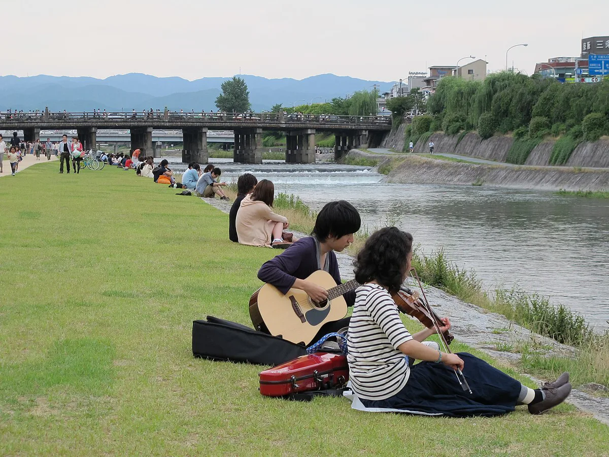
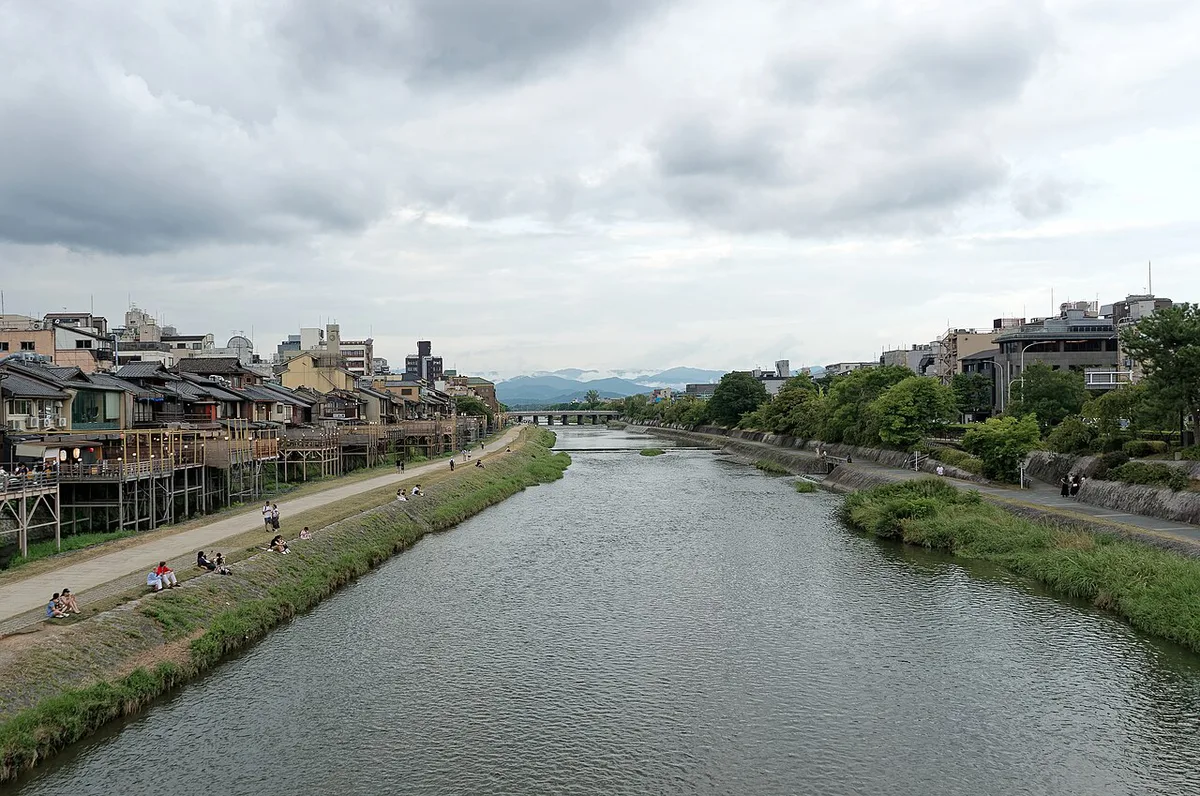
| Shijo to Gojo | Steps down to the water, the well-known evenly spaced sitting | Sunset | Couples, friends, solo sitters | High in evenings |
| Gojo to Shichijo | Wider, calmer banks with fewer restaurants | Midday or early evening | Photographers, runners, families | Low to moderate |
Best Things to Do Along the Kamo River
Start by deciding how much time you have. Three sample routes follow, and all three are rough estimates you should calibrate with a map. Along the way, you can watch birds, browse shops, and eat cheaply. Ducks give the river its name, since kamo means duck and gawa means river. Herons and cormorants also work the shallows. A French reference adds black kites and egrets to the list. Near Sanjo, one reviewer praises Naito Shoten, a brush and broom shop, and says it dates to 1818. Treat that date as unverified until you check the shop. Ogawa Coffee sits on the same corner, according to the same review. At the Demachiyanagi delta, Shimogamo Shrine and its Tadasu no Mori forest stand at the point where the Kamo meets the Takano River.
Plan a 30-minute sit near Shijo, since the stretch from Shijo to Gojo runs high in evenings.
- 30-minute sit (estimate): Go down the steps near Shijo Ohashi, pick a gap on the bank, and watch the water. One reviewer planned 10 minutes and stayed half an hour.
- 90-minute stroll (estimate): Start at Demachiyanagi and walk south along the bank toward Sanjo. Stop for coffee, then finish near Shijo with a look at the Ponto-cho terraces.
- Half-day route (estimate): Add Shimogamo Shrine and Tadasu no Mori at the start. Walk south through Marutamachi and Sanjo, break for lunch, then continue to Gojo or Shichijo before dinner.
Best Time to Visit: Season-by-Season and Time of Day
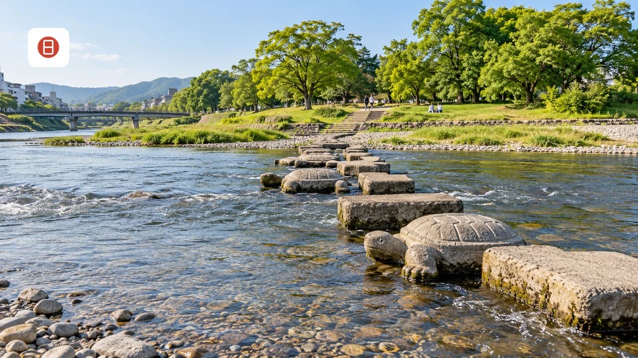
Every season gives the river a different job. Spring brings cherry blossoms, and a local guide calls the east-bank stretch from Sanjo Ohashi to Shichijo Ohashi the Flower Hallway. That stretch draws crowds, so go early. Summer brings humidity, rain and the evening terrace season from May to September. Autumn adds foliage along the banks. Winter is the quietest period, so you can sit nearly alone, though you will want a warm layer. Water levels matter too. A French reference says the river usually runs under one meter deep outside the rainy season, and that stepping stones allow crossings at several points. After heavy rain, that picture changes quickly. Stay on the paths and off the water's edge whenever the river is high or rain is forecast.
| Season | What to expect | Trade-off |
|---|---|---|
| Spring | Cherry blossoms along the banks, especially the east side from Sanjo to Shichijo | Peak crowds; go early |
| Early summer to September | Noryo-yuka terraces on the west bank, evening cool | Heat, humidity and rain; book ahead |
| Early August | Tanabata lantern event on the riverside (unverified; check dates) | Evening crowds |
| Autumn | Foliage along the banks | Weekend crowds near Shijo |
| Winter | Quiet banks, clear light | Cold; fewer people sitting out |
Summer Noryo-yuka and Evening Dining: How to Book
Noryo-yuka are raised dining platforms built over the water from May to September, mainly along the west bank between Nijo and Gojo. Date ranges can shift, so confirm them with the Kyoto Kamogawa Noryo-Yuka Union or Kyoto city sources. Most restaurants open the platforms in the evening once temperatures drop. During cooler May, June and September, some also serve in the daytime. Popular restaurants fill their reservation books quickly, so book early. One directory says reservations are generally not cancelled for rain, so call ahead if the forecast turns. Treat that as a reason to confirm the policy, not a promise. The casual alternative costs far less. Buy convenience-store takeout, walk down to the bank, and eat on the steps near Shijo. Price tiers are straightforward: terrace dining is the splurge option, Ponto-cho lanes sit in the middle, and a riverbank picnic is the budget choice. Check current menu prices on each restaurant's own page, since we have no verified figures.
How to Get There and Around
Use the Keihan Line for most of the route. The Keihan Main Line and Oto Line run along the east bank, according to a Kyoto Prefecture-supervised directory. Six stations give you easy access to different stretches. Hankyu, city subway and bus options also serve the Kawaramachi area, but verify station names and routes on each operator's page before you travel. The river is crossed by many bridges, so you can switch banks as you walk. Shijo Ohashi and Sanjo Ohashi are the two best-known crossings. On the north half, pair a Marutamachi-to-Demachiyanagi walk with a visit to the palace park via the Kyoto Imperial Palace Guide: Visiting the Former Royal Residence. Confirm any walking time on a map before you plan around it.
- Demachiyanagi: northern end, near the Kamogawa Delta
- Jingu-Marutamachi: access to the palace-side stretch
- Sanjo: bridges, cafés and the Naito Shoten area
- Gion-Shijo: the Shijo sitting steps and Ponto-cho
- Kiyomizu-Gojo: the calmer lower stretch
- Shichijo: southern end of the cherry walk
Cost, Hours and Access
Walking the river costs nothing, and the banks stay open at any hour. A directory entry lists the hours simply as walk anytime. Your spending depends on what you add. Coffee, takeout and shopping are optional. Yuka dining is the largest cost, and nearby paid sights have their own admission fees that you should check on official pages. Evening lighting is modest, so use well-lit paths after dark and watch your footing on the steps. Bring a rain layer in summer and sun protection at midday. Do not rely on the river as a rain-day plan, since high water can close access to the banks.
Where to Stay Near the Kamo River
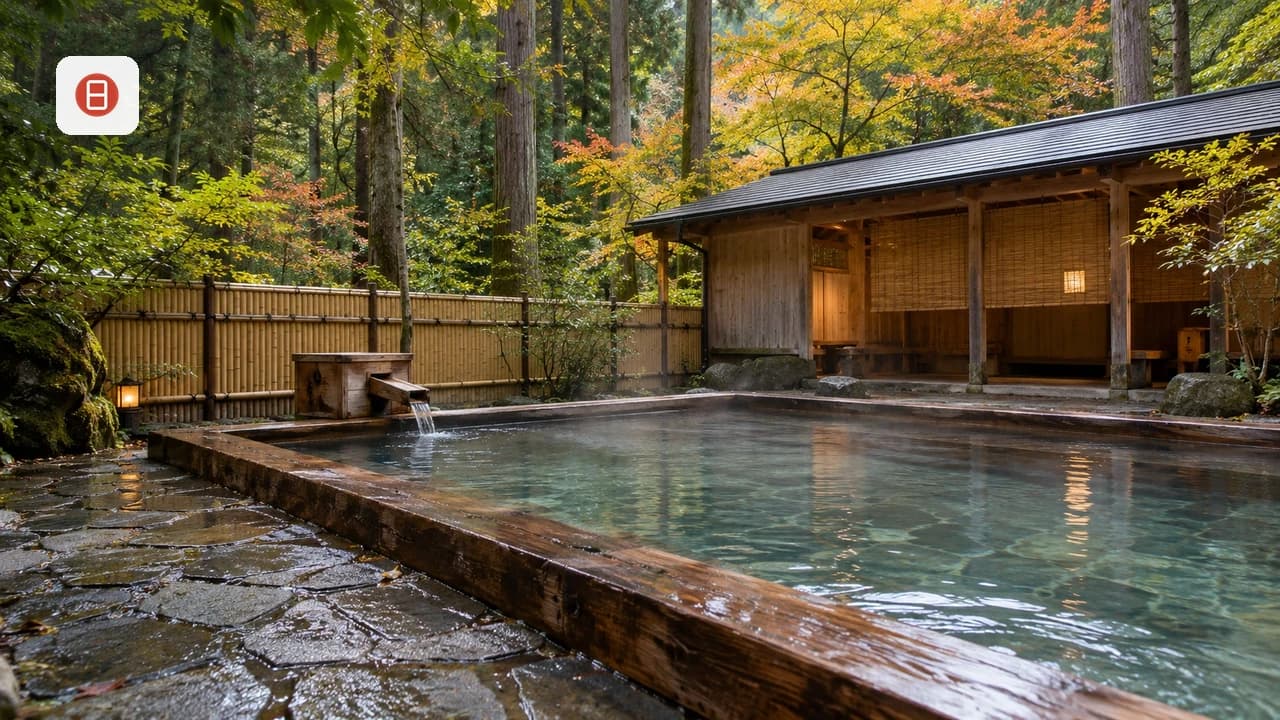
Choose your base by what you want from the evenings. Gion puts you near the Shijo steps and the east bank. Kawaramachi keeps shopping and dining within a short stroll of the water. Demachiyanagi gives a calmer base near the delta and the northern walks. Our 9 Best Areas to Stay in Kyoto Travel Guide (2026) breaks down each district in detail. For a soak after a long walk, see Kurama Onsen. Other options appear in Kyoto's onsen options. Check opening details on the official Kurama Onsen page before you go. We have not verified specific hotel names, so look for lodging by neighborhood first and read current reviews before booking.
History and Name in Brief
The name means duck river. A French reference traces the first kanji to wild ducks and notes that the river appears in records written in 815. When the Heian capital was founded in the late eighth century, the river was reportedly diverted to flow east of the palace. Floods were a recurring threat, and the banks are now reinforced with concrete. In the early 1600s, the merchant Suminokura Ryoi built the Takase canal alongside it for transport. Sanjo Ohashi was regarded as the end of the Tokaido road in the Edo period. Hiroshige's print series shows the bridge as station 55. Use these details as background and confirm anything you plan to repeat with Kyoto city sources.
Mistakes to Avoid and Who Should Skip It
Most disappointment comes from expecting a headline attraction. The Kamo River rewards slow time, not checklists. Avoid peak spots without a plan, and do not assume the river sits far from the main sights, because it runs through the central districts. Skip it if you want dramatic scenery. Also skip it if you have only a few hours in Kyoto and have not yet seen the major temples.
- Leaving litter on the banks, especially after evening picnics
- Feeding birds or kites: check posted rules before you share food
- Visiting at midday in summer without shade or water
- Booking a yuka table at the last minute
- Stepping on the stones or going to the water's edge when the river is high
- Expecting a single sight instead of a long, flexible walk
Frequently Asked Questions
Is the Kamo River worth visiting in Kyoto?
Yes, as a relaxed walking and sitting route. It suits slow mornings and evenings. Skip it if you want dramatic scenery or only have a few hours for the major temples.
How long should you spend at the Kamo River?
Plan about 30 minutes for a sit near Shijo. A 90-minute stroll from Demachiyanagi toward Sanjo works well. A half-day route adds Shimogamo Shrine and a lunch stop. All three are estimates, so check a map.
When is the best time to see cherry blossoms or enjoy summer dining along the Kamo River?
Cherry blossoms line the east bank between Sanjo Ohashi and Shichijo Ohashi in spring. Noryo-yuka dining runs roughly May to September on the west bank. Confirm dates with the Kyoto Kamogawa Noryo-Yuka Union.
Is the Kamo River free, and when is it open?
Walking the banks costs nothing. A directory lists the hours as walk anytime. You pay only for food, yuka dining or nearby paid sights.
Which station is closest to the Kamo River?
That depends on your stretch. The Keihan Main Line and Oto Line run along the east bank. Useful stops include Shichijo, Kiyomizu-Gojo, Gion-Shijo, Sanjo, Jingu-Marutamachi and Demachiyanagi.
Can you walk along the Kamo River from Gion to Demachiyanagi?
Gion-Shijo and Demachiyanagi are both Keihan stops, and the bank path links the central stretches. We have no verified walking time, so check a map app. Doing it in sections lets you stop for coffee.
Do you need to reserve a Noryo-yuka table?
Reservations are strongly advised. Popular restaurants keep long booking lists. One directory says bookings are generally not cancelled for rain, so call ahead.
Is it safe to enter the water or cross the stepping stones?
Avoid both when the river is high or rain is forecast. A French reference says the water is usually under one meter deep outside the rainy season. Conditions can change fast, so stay on the paths.
Free: The Kyoto Essentials guide
Top things to do, where to stay, a perfect day plan, getting around, and the best time to go — a Kyoto mini-guide you can take offline.
You might also like
Continue reading
More guides you'll find useful