Kurama to Kibune Hike Guide: Route, Map & Logistics (Kyoto)
Plan your Kurama to Kibune hike with our detailed guide. Includes Eizan Railway logistics, trail landmarks like Kurama-dera, costs, and the best direction to walk.
On this page
Last updated July 2026, the kurama to kibune hike remains one of the easiest ways to trade central Kyoto's crowds for the mountains. It combines pine forest, shrines, and a village dinner without a car or a tour guide. Over roughly 3.9km and two to three hours, the trail links Kurama-dera Temple and Yuki-jinja Shrine to the riverside village of Kibune, all reachable by a single scenic train line from Demachiyanagi Station. This guide covers which direction to walk, what each landmark along the way actually looks like, and the transit and timing details that competitor write-ups tend to skip.
Hike Overview: Distance, Time, and Difficulty
The kurama to kibune hike covers approximately 3.9km one-way and takes most walkers 2 to 3 hours, not counting time spent inside Kurama-dera or resting at the summit. In editorial assessment, the trail is best described as moderate: the opening stretch is a steady uphill climb on stone steps. At the same time, the forested ridge and descent into Kibune are gentler underfoot but still uneven with exposed tree roots. Sturdy, closed-toe shoes with grip are worth packing regardless of season, since the path is dirt and stone rather than paved throughout.
- Distance: approx. 3.9km one-way
- Time: 2 to 3 hours of walking, plus temple and shrine stops
- Difficulty: moderate, steep at the start, rooted terrain near the summit
- Start point: Kurama Station on the Eizan Line
- Finish point: Kibune-guchi Station on the Eizan Line
Getting to the Trailhead: Eizan Railway Logistics
Access to the trailhead starts at Demachiyanagi Station, the northern terminus of the Keihan Line along the Kamo-gawa River and the departure point for the Eizan Electric Railway. From here, board a Kurama-bound Eizan Line train and ride it to the last stop, Kurama Station. The scenic 30-minute journey through the Kitayama Mountains turns into a well-known momiji tunnel of autumn foliage in November. IC cards such as ICOCA and Suica are accepted for tap-in, tap-out fares on the Eizan Line, so there is no need to buy a separate paper ticket if traveling with a rechargeable card. At the end of the hike, the same line is boarded again at Kibune-guchi Station for the return trip to Demachiyanagi, keeping the whole day-trip logistics loop on a single railway.
Choosing Your Direction: Kurama-to-Kibune vs. Kibune-to-Kurama
Most guides default to walking from Kurama to Kibune, and for good reason: this direction front-loads the steepest climbing, through Kurama-dera's gate and up to the main hall. At the same time, the second half is a gentler, largely downhill walk through the Kinone-michi root path into Kibune village. Finishing in Kibune also times the hike to end near the village's riverside restaurants and the walk down to Kibune-guchi Station, making the last stretch feel like a reward rather than a chore. Walking the reverse route, from Kibune to Kurama, front-loads a similarly steep ascent out of the village but ends the hike at Kurama Station and the temple's lower gate rather than beside the Kibune-gawa. Either direction covers the same 3.9km and takes roughly the same 2 to 3 hours. As a result, the choice comes down to whether uphill effort is preferred early or late, and whether Kibune's riverside dining is wanted as a finish-line reward.
Hiking Kurama-to-Kibune places hardest climbing upfront through the temple. The gentler descent through the root path rewards the effort by ending near Kibune village's riverside dining—particularly appealing May through September when kawadoko platforms operate directly over the river.
Step-by-Step Trail Itinerary: Kurama-dera to Kibune Village
The route below follows the recommended Kurama-to-Kibune direction, moving from the trailhead near Kurama Station up through Kurama-dera Temple, over the ridge, and down into Kibune village.
- Kurama Tengu and Station Area: Exit Kurama Station and look for the bright red Tengu statue in the parking lot, a mythical creature tied to local folklore. Continue past it and down to Kurama's main street, then turn and walk uphill toward the temple gate.
- Entering Kurama-dera: Climb the steps to the main gate and pay the entry fee of ¥500. A short funicular railway partway up lifts visitors to just below the main hall for those wanting to skip the first flight of stairs, though the walking climb here is considered easy enough that most hikers continue on foot.
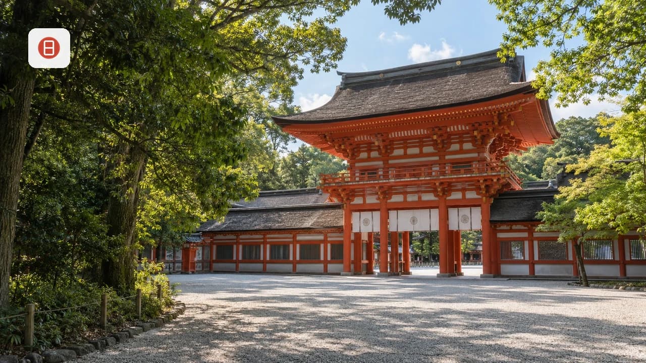
- Yuki-jinja Shrine and the Giant Cedar: About 100m past the start, a wooden gatehouse marks the entrance to Yuki-jinja Shrine, the protector shrine of the village and temple. The steps up pass a towering Kitayama cedar just in front of the shrine's main hall.
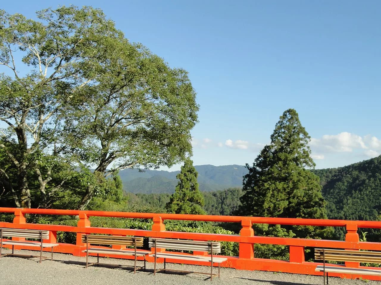
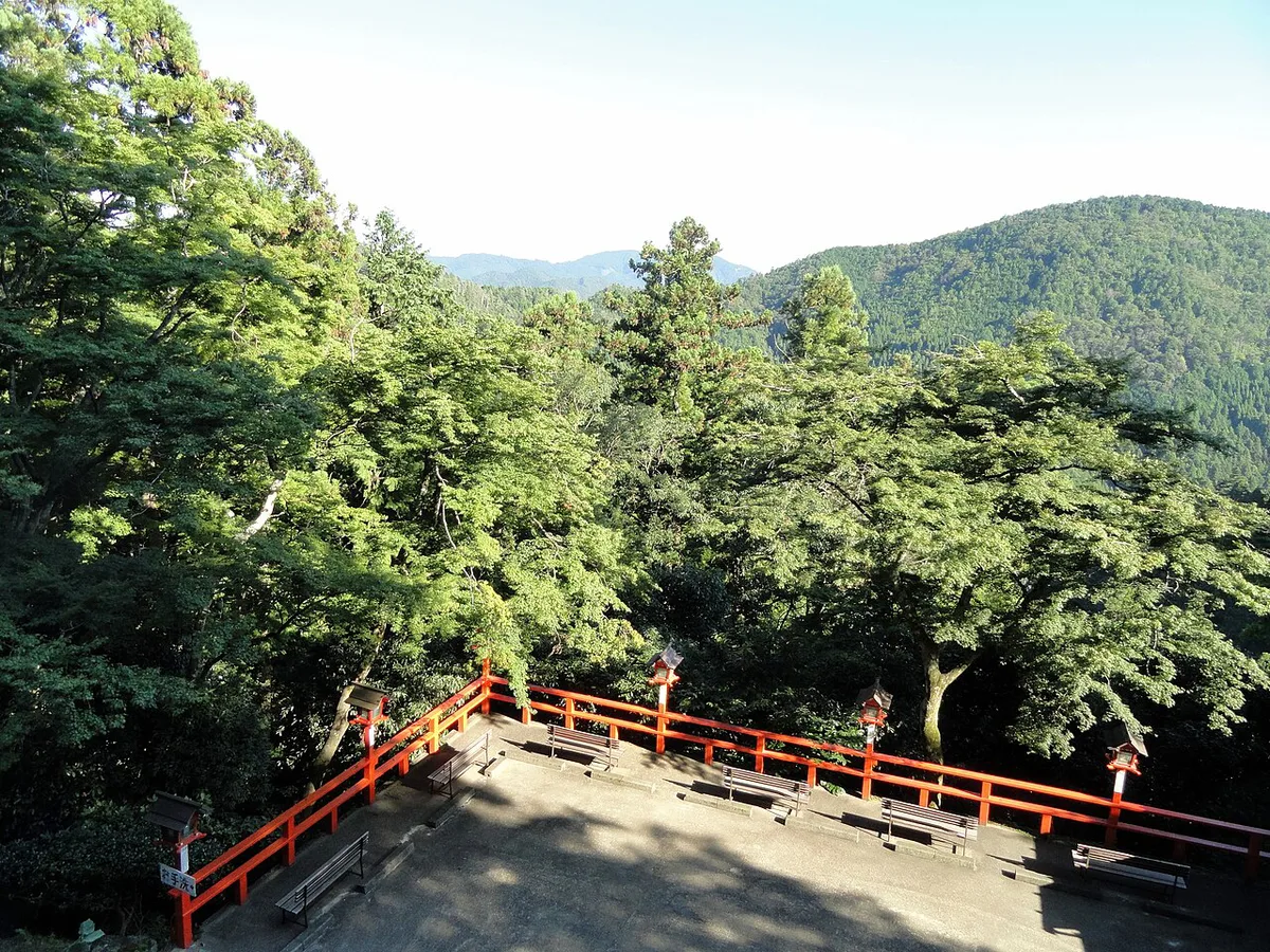
- The Main Hall (Hondo) and Mountain Views: Past Yuki-jinja, the trail climbs through a large wooden gate and several flights of lantern-lined steps before opening onto the broad plaza in front of Kurama-dera's main hall, a good spot to rest before continuing.
- The Kinone-michi (Root Path) and Summit: From the main hall, the trail continues left through a vermillion-and-white building and climbs past a bell tower to the ridge summit, marked by the Yoshitsune Sekurabe Ishi standing stone. From there, the Kinone-michi, or root path, runs along the ridge, named for the tangle of exposed tree roots underfoot, before reaching the Osugi Gongen shrine.
- Descending into Kibune Village: Past the Osugi Gongen, the trail turns downhill via a flight of stone steps that becomes the main descent into Kibune. The trail ends at a bridge in the village itself; from that bridge, it is a walk up to Kifune-jinja Shrine and the riverside restaurants, or down toward Kibune-guchi Station.
What to Do in Kibune Village Post-Hike
Kibune village centers on Kifune-jinja Shrine, reached by a short uphill walk from the trail's exit bridge. Its slope of red lanterns is one of the most photographed approaches in the northern hills. Between roughly May and September, the village's riverside restaurants set up kawadoko, wooden dining platforms built directly over the Kibune-gawa, serving meals in the cool spray of the river below. This seasonal dining window makes early-to-mid-summer a rewarding time to schedule the hike so it ends with a kawadoko meal. Outside the kawadoko season, Kibune's restaurants and cafes still operate at ground level, and the walk along the village's main lane past the shrine remains worthwhile regardless of month.
The Last Mile: Kibune Village to Kibune-guchi Station
One detail competitor guides tend to gloss over is the roughly 2km stretch between Kibune village and Kibune-guchi Station, which is not directly adjacent to the shrine or restaurants. Hikers can walk this final leg along the road following the river. This takes around 30 minutes at an easy pace and offers a last look at the valley. Alternatively, catch a local bus that runs between the village and the station for those short on time or energy after the climb. The bus is the faster option and worth prioritizing if aiming to catch a specific Eizan Line departure back to Demachiyanagi. Walking is the better choice for anyone still wanting to soak in the scenery.
Costs, Tickets, and Essential Gear
Budgeting for the kurama to kibune hike is straightforward. The main fixed cost is the ¥500 entry fee to Kurama-dera, payable at the gate, plus standard Eizan Line fares from Demachiyanagi to Kurama and from Kibune-guchi back, both payable with an IC card. No hiking permits or reservations are required. Footwear matters more than any other gear choice here. This is because the stone steps near Kurama-dera and the root-crossed Kinone-michi near the summit are uneven. Closed-toe shoes with real tread are strongly recommended over sandals or fashion sneakers. A refillable water bottle, a light jacket for the shaded forest sections, and a change of socks for post-hike comfort in Kibune round out a sensible packing list.
Mistakes to Avoid on the Kurama-Kibune Trail
The most common planning mistake is underestimating transit time and arriving at Kurama Station too late. Leave enough time to finish the hike and enter Kurama-dera before dinner reservations or the last useful bus from Kibune. Building in the full 2 to 3 hour walking window plus temple time avoids a rushed descent. Winter travel deserves extra caution. This is because the stone steps around Kurama-dera and the forest sections near the summit can hold snow or ice. This makes already-uneven footing more hazardous. Slower pacing and grippy footwear are worth prioritizing if hiking between December and February. Finally, don't treat the Eizan Line schedule casually on the way out of Kibune-guchi Station: services thin out later in the day. As a result, checking return train times before starting the hike, rather than after finishing it, prevents an unwanted wait at a small rural platform.
The full day-trip—30-minute train ride to Kurama, 2–3 hours hiking, plus 30 minutes to Kibune-guchi Station—requires checking return Eizan Line schedules before starting. Services thin out later in the day, making advance planning essential to avoid a long wait at a rural platform.
Nearby Kyoto Extensions
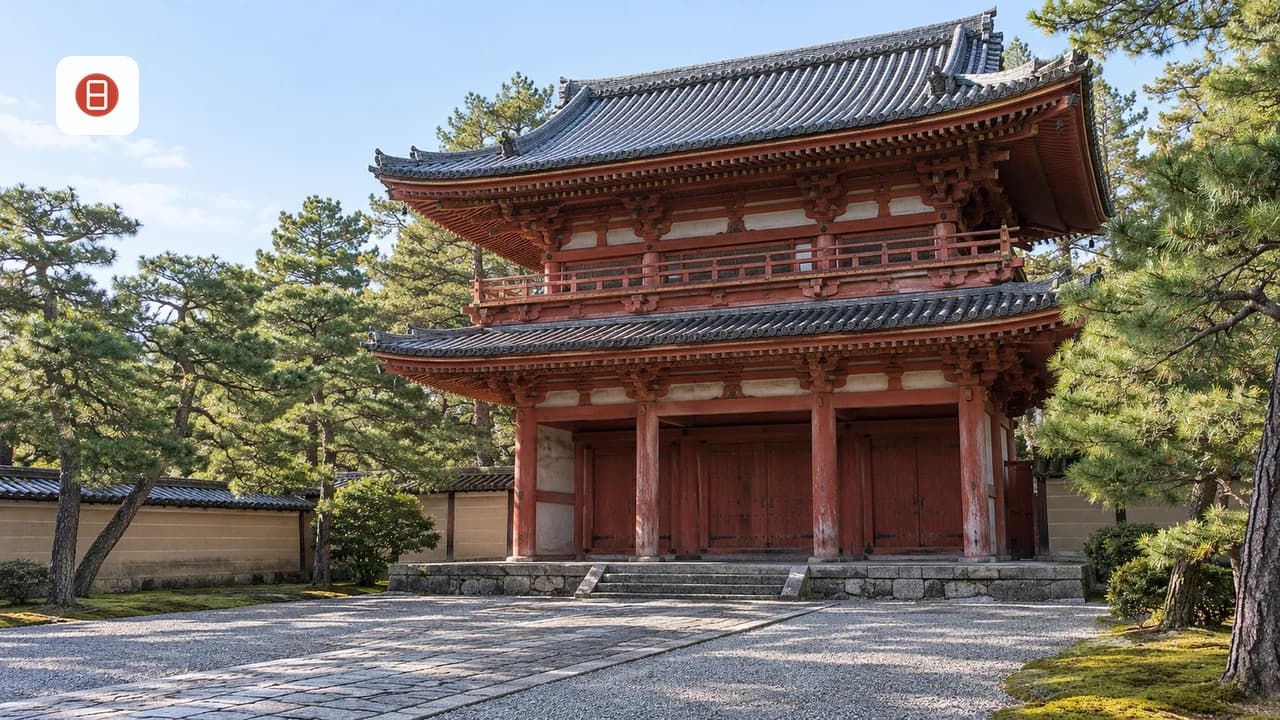
The kurama to kibune hike pairs naturally with other Kyoto experiences depending on how the rest of the day or trip is shaped. For another nature-focused walk without leaving the city, the Philosopher's Path canal walk offers a flatter, more urban contrast to Kurama's mountain trail. To balance the day's outdoor exertion with formal architecture and gardens, the Kyoto Imperial Palace grounds provide a flat, structured counterpoint to the steep temple stairs. Hikers drawn to mountain-temple combinations may also want to add Daigo-ji Temple's mountain complex to a Kyoto itinerary. Traveling with kids or looking for a lower-effort alternative day trip, Toei Kyoto Studio Park's samurai sets and the Kyoto Railway Museum's steam locomotives both make family-friendly counterpoints to a half-day mountain hike.
Quick Stats: Kurama-Kibune vs. Fushimi Inari
Travelers weighing which Kyoto hike to prioritize often compare the Kurama-to-Kibune trail against the Mount Inari-san climb at Fushimi Inari Shrine, Kyoto's other well-known hiking option. The two differ meaningfully in setting, crowd levels, and payoff, as summarized below.
| Feature | Kurama to Kibune Hike | Fushimi Inari Hike |
|---|---|---|
| Distance | Approx. 3.9km one-way | Approx. 4km round-trip to summit |
| Setting | Forest and mountain shrines, Kitayama Mountains | Thousands of vermillion torii gates |
| Access | Eizan Line from Demachiyanagi Station | JR Nara Line or Keihan Line, closer to central Kyoto |
| Crowd levels | Comparatively quiet, especially on weekdays | Consistently busy, especially near the base |
| Post-hike reward | Kibune village dining, including seasonal kawadoko | Inari Station area food stalls |
Check Trail Conditions and Closure Notices Before Starting
Before committing to the Kurama-to-Kibune hike, check for local closure notices rather than assuming the ridge path is open. This is a forest trail through temple land, not a paved city walk. Heavy rain, typhoons, fallen branches, winter ice, or repair work can temporarily close sections between Kurama-dera, the Kinone-michi root path, and Kibune.
Look for posted signs at Kurama Station, the Kurama-dera gate area, and the trail exits near Kibune before you pass the point where turning back becomes inconvenient. If a rope, barrier, or Japanese/English notice marks the mountain path as closed, do not continue over the ridge. Visit Kurama-dera from the Kurama side, then return by train, or approach Kibune separately from Kibune-guchi Station. After bad weather, build a backup plan into the day, especially if you have kawadoko dining reservations or onward plans in central Kyoto.
See our Kyoto tourism attractions guide for the broader city overview.
Planning sources: Kyoto Travel access guide · Eizan Railway. Further reading: Kyoto on Wikivoyage · Kyoto on Wikipedia
Frequently Asked Questions
Is the Kurama to Kibune hike difficult?
The trail is generally considered moderate rather than difficult. The steepest section comes right at the start, climbing stone steps from Kurama Station up through Kurama-dera's gate to the main hall. At the same time, the forested path over the ridge and down to Kibune is less steep but crosses exposed tree roots on the Kinone-michi that require careful footing.
Which direction is better for the Kurama to Kibune hike?
Walking from Kurama to Kibune is the direction most guides recommend. This is because it puts the steepest climbing near the start at Kurama-dera. It turns the second half into a gentler descent through the Kinone-michi into Kibune village, finishing near the riverside restaurants and the walk down to Kibune-guchi Station.
How long does the Kurama to Kibune hike take?
Plan on 2 to 3 hours of walking for the roughly 3.9km trail, plus extra time for exploring Kurama-dera's main hall and grounds. Add the 30-minute Eizan Line ride each way from Demachiyanagi Station when budgeting time for the full day trip.
Is the Kurama to Kibune hike open in winter?
The trail generally stays open year-round, but winter conditions add risk: stone steps near Kurama-dera and shaded sections near the summit can hold snow or ice. Grippy, closed-toe footwear and a slower pace are worth prioritizing for a winter hike.
Do I need cash for the Kurama to Kibune hike?
Some cash is useful for the ¥500 Kurama-dera entry fee paid at the gate, though train fares on the Eizan Line can be covered with an IC card like ICOCA or Suica. Carrying at least small yen notes for the temple fee and any Kibune village dining is a safe approach.
Can you do the Kurama to Kibune hike without visiting the temple?
Kurama-dera sits directly on the main trail between Kurama Station and the summit. As a result, reaching Kibune on foot means passing through the temple grounds and paying its ¥500 entry fee. There is no separate hiking-only bypass around the temple on this route.
Free: The Kyoto Essentials guide
Top things to do, where to stay, a perfect day plan, getting around, and the best time to go — a Kyoto mini-guide you can take offline.
You might also like


Continue reading
More guides you'll find useful