Mount Yotei stands as a majestic symbol of Hokkaido's natural beauty and rugged volcanic landscape.
Travelers often call it Ezo Fuji because its perfect cone shape resembles Japan's most famous peak.
Exploring this dormant volcano offers a mix of challenging hikes and peaceful nature spots near the Niseko resort area. Whether you're planning your Niseko itinerary or exploring the broader region, Yotei's Niseko attractions deserve a top spot on your schedule.
Summit Crater and Must-See Highlights
The summit crater at 1,898 m is the defining reward of any Yotei hike. Walking the crater rim delivers a 360-degree panorama over the Niseko ski resort, the Shakotan Peninsula coast, and on clear days the Oshima Peninsula far to the south.
Aim to leave the trailhead by 05:00 to catch the low-angle morning light over the crater before afternoon cloud builds — this is also the safest window for completing the 8–11 hour round trip before dark.
Photographers aim for an early start — leaving the trailhead by 05:00 — to catch low-angle light over the crater before afternoon cloud builds. The shadow of the near-perfect cone is most dramatic in the morning hours when cast across the surrounding farmland below.
The crater itself can be circumnavigated fully or partially. The right-side approach from the crater lip is shorter but involves exposed scrambling over rocky formations. The left-side trail is a standard walking path that requires almost a full circuit of the rim to reach the official summit marker, so most guides recommend the left route for anyone not comfortable on steep rock.
Base-Level Parks and Natural Highlights
Fresh spring water flows directly from the mountain into the popular Fukidashi Park nearby. Visitors can fill their bottles with cold mineral water that has filtered through volcanic rock for decades, and the park sits within a short drive of the Makkari trailhead.
Another stunning location is Shinsen-numa, a high-altitude marshland with wooden boardwalks for easy walking. The wetland hosts alpine wildflowers through August and provides intimate views of the upper cone without any strenuous climbing.
The Kyogoku springs on the eastern side of the mountain are also worth visiting after a hike, particularly if you used the Kyogoku trailhead. Cold, clear water from the springs offers a natural refreshment stop accessible even to families who are not attempting the summit.
Cultural Context Around the Mountain
Local culture flourishes in the shadow of the mountain through various artistic and historical venues. The Arishima Memorial Museum honors the author Takeshiro Arishima, who lived in this scenic region and whose writing is inseparable from the Hokkaido landscape.
A small Shinto shrine sits between the Makkari trailhead parking lot and the official start of the trail. Most hikers pause here briefly before their climb — it is considered good practice on Japanese mountain trails, and the quiet moment of reflection is a meaningful way to begin a long day on the mountain.
The mountain itself holds deep significance as one of the Nihon Hyakumeizan — the 100 Famous Mountains of Japan, a list compiled by mountaineer Kyuya Fukada in 1964. Bagging this peak as part of the Hyakumeizan list is a recognized goal among serious Japanese hikers, giving Yotei prestige beyond its regional fame as Ezo Fuji.
Hiking Routes: Four Trails to the Summit
Four main trails lead to the summit crater, each approaching from a different side of the mountain. All four converge on the same crater rim, so route choice comes down to access, trailhead parking, and which descent line appeals to you.
The Makkari Route on the south slope is the most popular summer hiking trail. It gains elevation steadily through dense forest before emerging above the treeline around Station 8. The trail is clearly marked with numbered stations (1 through 10) that help hikers gauge pace. Note that Station 2.5 exists — the mountain has its own logic. Makkari is accessible by Donan Bus from JR Kutchan Station (get off at 羊蹄自然公園入口 Yotei Nature Park stop), though the bus stop is 1.8 km from the trailhead, adding 3.6 km round-trip to the day. The first bus departs Kutchan at 06:40 and arrives at the mountain by 07:12.
The Hirafu (Kutchan) Route on the northern slope offers the fastest access for visitors based in the Niseko ski village. It is steeper than Makkari but cuts travel time for those staying near the resort. The Kimobetsu Route on the western side is the least wooded option, with open slopes from about 1,400 m down that are also popular for ski touring in winter. The Kyogoku Route on the eastern side offers direct access to the best southwest-aspect crater ski terrain and connects conveniently with the Kyogoku springs for an after-hike reward.
- Makkari Route — south slope, most popular, accessible by bus from Kutchan (06:40 first bus), steady switchback gradient
- Hirafu/Kutchan Route — north slope, closest to Niseko resort area, steeper but shorter drive from the ski village
- Kimobetsu Route — western approach, open upper slopes, good for ski touring and crater access in winter
- Kyogoku Route — eastern side, connects to Kyogoku springs, best access to the southwest crater ski slope
| Route | Slope | Bus Access | Best For |
|---|---|---|---|
| Makkari | South | Yes — 06:40 from Kutchan | Summer hiking, most popular |
| Hirafu / Kutchan | North | No | Resort-based visitors, shorter drive |
| Kimobetsu | West | No | Open slopes, ski touring |
| Kyogoku | East | No | Southwest crater ski terrain, Kyogoku springs |
Ski Touring Routes and Backcountry Skiing
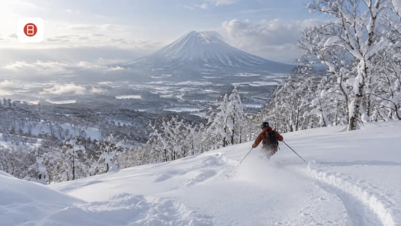
Winter transforms Mount Yotei into one of Hokkaido's most coveted backcountry ski destinations. The mountain is entirely uncontrolled — there is no avalanche mitigation, no marked winter routes, and no patrol. Every skier and snowboarder entering the mountain must carry a beacon, shovel, and probe, and must know how to use them.
All backcountry skiers must submit climbing intentions to local police via Mt-Compass before heading out. The mountain has no patrol and no avalanche mitigation — a beacon, shovel, and probe are mandatory, not optional.
The best skiing is consistently found below 1,300 m, where deep Hokkaido powder accumulates in well-spaced trees. Above that line, expect icy, hard-packed snow that requires crampons for most of the climb to the crater rim. Summit attempts need roughly 8 hours return; add 30 minutes if skiing into the crater itself.
Five established backcountry routes are popular in 2026. The Makkari Route gives fast elevation gain and access to the locally famous 1,000 m Terrace (テラス) — a natural plateau where most groups turn around. The Jinja-no-sawa Route (also called the Cemetery Route) is the go-to for the Delta Slope (デルタ斜面), a wide south-facing glade from 1,250 m to 600 m that rarely gets tracked out even on busy weekends. The Kimobetsu Route offers the widest open skiing terrain on the mountain. The Kyogoku Route has tight gullies and couloir options that suit experienced skiers seeking technical variation. The Makkimo Route, between Makkari and Kimobetsu, has the most picturesque native white birch glades on the mountain.
All skiers should submit climbing intentions to the local police either in person or online via Mt-Compass before heading out. Two routes — Makkari and Jinja-no-sawa — are accessible by the 06:40 bus from JR Kutchan Station. For guided backcountry access, outfitters like Rising Sun Guides, Niseko Mountain Guides, and Hokkaido Backcountry Club operate out of the Niseko resort area. Rising Sun Guides also offers splitboard rental for those without their own equipment.
How to Plan a Full Day on Mount Yotei
Preparation is the key to a safe and successful day on this massive volcano. Leave the trailhead no later than 06:00 to allow enough daylight for the full ascent and descent — the round trip takes 8 to 11 hours depending on pace and route. Hokkaido is bear country, and getting caught high on the mountain after dark is genuinely dangerous.
Pack at least 2 liters of water per person. There are no shops, vending machines, or water sources along any trail. The Yotei Hut above Station 8 offers emergency shelter but has no heat, running water, or toilet — it is not a resupply point. All food and water must be carried from the trailhead.
Register your hiking plans at the registration box located between the parking lot and the trailhead start. The form asks for group size, intended route, departure and expected return times, and clothing descriptions. This is effectively mandatory — it is the safety net if a rescue becomes necessary. Consult with local experts at Explore-Niseko.com to book guided tours for a safer experience, particularly for first-time visitors to Hokkaido's backcountry mountains.
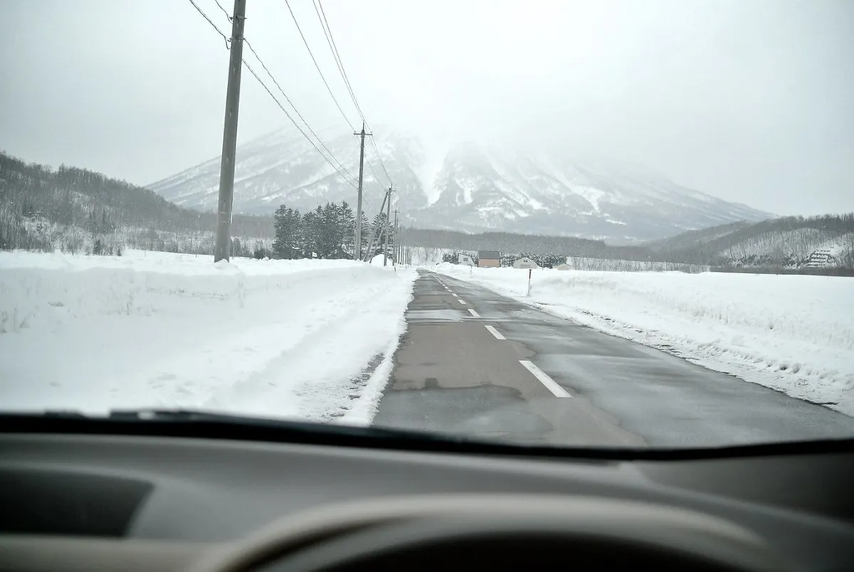
Most visitors base themselves in Kutchan or Niseko village and reach the trailhead by rental car. A car is strongly recommended because it gives flexibility with start time and reduces the day's total distance. Bus access exists on the Makkari and Jinja-no-sawa sides, but the bus stop is 1.8 km short of the Makkari trailhead, which adds meaningful distance to an already long day.
Family-Friendly and Budget-Friendly Options
Families with young children or those not ready for a summit attempt have good options at the mountain base. Picnic areas near the Makkari trailhead offer sweeping views of the cone without any entry fee — the mountain is public land within Shikotsu-Toya National Park and entirely free to access.
Fukidashi Park is the easiest family option: flat, paved paths, free entry, and a working spring where children can splash clean mountain water. The park pairs well with a short loop hike of under an hour that stays in the forest near the mountain base.
After any walk, the nearby Makkari area has farm stands selling fresh dairy and vegetables at low prices. Finish your day with a soak at the Niseko Konbu Onsen or the Niseko Goshiki Onsen to soothe muscles after hiking — both are affordable, genuinely restorative, and no reservation is needed.
Weather, Seasons, and Conditions in 2026
The hiking season runs from early July to early October. Trails are snow-free and alpine wildflowers bloom through August. July and August offer the longest daylight and most stable weather windows, making them ideal for summit attempts. September brings autumn color to the crater, but afternoon storms become more frequent — start earlier and watch the forecast closely.
Outside the summer window, snow arrives quickly and the mountain demands winter mountaineering experience. Spring (May–June) and late autumn (November) still carry significant snowpack on the upper slopes, and summit-bound climbers require crampons and ice axe skills even after the official summer season ends.
Weather can change rapidly at any time of year. Fog rolls in fast from the Sea of Japan side, and wind at the crater rim can be severe even when conditions below the treeline feel calm. Check the daily mountain forecast via the Japan Meteorological Agency or the official Visit Hokkaido site before departure, and be genuinely prepared to turn around if conditions deteriorate above Station 7.
Safety, Conservation, and Leave No Trace
Preserving the natural integrity of the mountain is a priority for the local community and visitors. The trails on Yotei are maintained by local volunteers and prefectural staff — following marked routes prevents erosion on the steep volcanic slopes and protects the delicate alpine flora above the treeline.
Using digital maps and reliable navigation tools helps prevent hikers from getting lost on the vast slopes. Download an offline map before your trip; mobile signal is unreliable above the treeline on all four routes. GPS tracks for each route are available from HokkaidoWilds.org as free GeoPDF downloads compatible with the Avenza Maps app.
Follow Leave No Trace principles by carrying out all trash and respecting the alpine environment. Pack out human waste if camping overnight near the hut — facilities do not exist on the mountain. Understanding the local environment ensures that the mountain remains beautiful for future generations of travelers.
Frequently Asked Questions
Which mount yotei visitor guide options fit first-time visitors?
First-time visitors should start with the Makkari trail for a manageable hiking experience. It offers the most consistent path and clear signage for safety. For a more relaxed trip, visiting Fukidashi Park provides great views without the strenuous climb. You can also relax at Niseko Konbu Onsen after your visit.
How much time should you plan for a Mount Yotei visit?
If you plan to hike to the summit, allow at least eight to ten hours for the full trip. This includes time for breaks and enjoying the views at the top. For base attractions like parks and museums, a half-day trip of four hours is usually sufficient for most families.
What should travelers avoid when planning a hike?
Avoid starting your hike late in the day as the mountain weather can change very quickly. Do not attempt the climb without proper footwear and sufficient water supplies. Travelers should also avoid hiking alone if they are not experienced with steep, unpatrolled volcanic terrain in Hokkaido.
Is Mount Yotei worth including on a short itinerary?
Yes, the mountain is worth seeing even if you only have a few hours in the area. You can view the peak from many spots in the valley or visit a base park quickly. It remains the most iconic landmark in the region and provides excellent photo opportunities for every traveler.
Mount Yotei offers a diverse range of experiences for every type of traveler visiting Hokkaido.
Whether you choose to climb the summit or enjoy the base parks, the mountain leaves a lasting impression.
Finish your day with a soak in the Niseko Goshiki Onsen to soothe your muscles after exploring.
To verify current details, consult the Mount Yotei guide on Japan and Mount Yotei on Wikipedia.
For more Niseko trip planning, see our Niseko Summer Activities guide.